Denman Island Trust Area geodata
Denman Island Trust Area (British Columbia) is a populated place; located in Canada in America/Vancouver (GMT-7) time zone. With population of 1,165 people, there are 968 cities with bigger population in this country. Compared to other cities in Canada, 71% of cities are located further ↓South; 97.5% of cities are located further →East and 68.7% of cities have higher elevation than Denman Island Trust Area. Note1
Current local time in Denman Island Trust Area:
02:52 AM, ThursdayDifference from your time zone: hours


Denman Island Trust Area GPS coordinates[2]
49° 33' 6.804" North, 124° 47' 55.716" West
| Map corner | latitude | longitude |
|---|---|---|
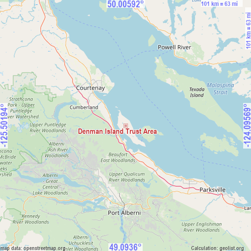
| Upper-left | 50.00592°, | -125.50194° |
| Center: | 49.55189°, | -124.79881° |
| Lower-right: | 49.0936°, | -124.09569° |
| Map W x H: | 101.4×101.4 km | = 63×63mi |
| max Lat: | 73.03752° ⇑29% North |
| Denman Island Trust Area: | 49.55189° |
| min Lat: | ⇓71% South 42.05009° |
| min Long | Denman Island T | max Long |
| -139.43328° | -124.79881° | -52.70931° |
| W 2.5%⇐ | ⇒97.5% E |
Elevation
Elevation of Denman Island Trust Area is 60 m = 197 ft, and this is 194.4 m = 638 ft below average elevation for this country.
| Max E: |
1518 m = 4980 ft | 68.7% |
| Avg. | 254.4 m = 835 ft | |
| Denman Island Trust Area | 60 m = 197 ft | |
Min E: |
-2 m = -7 ft | 31.3% |
See also: Canada elevation on elevation.city.
Geographical zone
Denman Island Trust Area is located in North temperate zone (between Tropic of Cancer and the Arctic Circle). Distance of this North polar circle is 1891.5 km =1175.3 mi to North.| Distance of | km | miles | from Denman Island Trust Area |
|---|---|---|---|
| North Pole | 4497.4 | 2794.6 | to North |
| Arctic Circle | 1891.5 | 1175.3 | to North |
| Tropic Cancer | 2903.7 | 1804.3 | to South |
| Equator | 5509.7 | 3423.6 | to South |


Nearby cities:
15 places around Denman Island Trust Area: (largest is in red/bold)
• Coombs
39.2 km =24.4 mi,  135°
135°
• Courtenay
20.5 km =12.7 mi,  316°
316°
• Cumberland
18.5 km =11.5 mi,  292°
292°
• Dashwood
28.9 km =18 mi, 135°
• Denman Island
2.6 km =1.6 mi,  215°
215°
• Englishman River South
48 km =29.8 mi,  128°
128°
• Fairwinds
57.4 km =35.7 mi,  122°
122°
• French Creek
39.7 km =24.7 mi, 126°
• Hornby Island
9.5 km =5.9 mi,  101°
101°
• Parksville
43.4 km =27 mi, 126°
• Port Alberni
34.5 km =21.4 mi,  180°
180°
• Powell River
37 km =23 mi,  32°
32°
• Puntledge
22.2 km =13.8 mi,  303°
303°
• Royston
15 km =9.3 mi,  314°
314°
• South Pender Harbour
56.3 km =35 mi,  82°
82°
Sources, notices
• [Note1] Compared only with cities in Canada existing in our database
• [Src1] Map data: © OpenStreetMap contributors (CC-BY-SA)
• [Src2] Other city data from geonames.org with taken over terms of usage.
• [Src3] Geographical zone / Annual Mean Temperature by Robert A. Rohde @ Wikipedia
