Gamboma geodata
Gamboma (Plateaux) is a populated place; located in Republic of the Congo in Africa/Brazzaville (GMT+1) time zone. With population of 20,877 people, there are 8 cities with bigger population in this country. Compared to other cities in Republic of the Congo, 68.4% of cities are located further ↓South; 84.2% of cities are located further ←West and 63.2% of cities have lower elevation than Gamboma. Note1


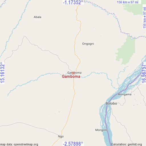
Gamboma GPS coordinates[2]
1° 52' 35.004" South, 15° 51' 51.984" East
| Map corner | latitude | longitude |
|---|---|---|
| Upper-left | -1.17352°, | 15.16132° |
| Center: | -1.87639°, | 15.86444° |
| Lower-right: | -2.57898°, | 16.56757° |
| Map W x H: | 156.3×156.3 km | = 97.1×97.1mi |
| max Lat: | 1.64806° ⇑31.6% North |
| Gamboma: | -1.87639° |
| min Lat: | ⇓68.4% South -4.77609° |
| min Long | Gamboma | max Long |
| 11.8125° | 15.86444° | 18.05981° |
| W 84.2%⇐ | ⇒15.8% E |
Elevation
Elevation of Gamboma is 366 m = 1201 ft, and this is 47 m = 154 ft above average elevation for this country.
| Max E: |
790 m = 2592 ft | 36.8% |
| Gamboma | 366 m 1201 ft | |
| Avg. | 319 m = 1047 ft | |
Min E: |
7 m = 23 ft | 63.2% |
See also: Republic of the Congo elevation on elevation.city.
Geographical zone
Gamboma is located in South Torrid zone (between Equator and Tropic of Capricorn). Distance of Equator is 208.6 km =129.6 mi to North.| Distance of | km | miles | from Gamboma |
|---|---|---|---|
| Equator | 208.6 | 129.6 | to North |
| Tropic Capricorn | 2397.3 | 1489.6 | to South |
| Antarctic Circle | 7192.5 | 4469.2 | to South |
| South Pole | 9798.4 | 6088.4 | to South |


Nearby cities:
15 places around Gamboma: (largest is in red/bold)
• Boukiéro
266.1 km =165.3 mi,  193°
193°
• Brazzaville
273.4 km =169.9 mi, 193°
• Djambala
144.1 km =89.5 mi,  238°
238°
• Dolisie
439 km =272.8 mi,  233°
233°
• Ewo
161 km =100 mi,  313°
313°
• Kayes
386 km =239.8 mi, 227°
• Kinkala
302.1 km =187.7 mi,  203°
203°
• Madingou
360.8 km =224.2 mi, 225°
• Makoua
211 km =131.1 mi,  353°
353°
• Mossendjo
370.8 km =230.4 mi,  251°
251°
• Nkayi
384.4 km =238.9 mi, 228°
• Ouésso
388.6 km =241.5 mi,  3°
3°
• Owando
155.1 km =96.4 mi, 1°
• Sibiti
343.9 km =213.7 mi, 234°
• Sémbé
417.1 km =259.2 mi,  339°
339°
Sources, notices
• [Note1] Compared only with cities in Republic of the Congo existing in our database
• [Src1] Map data: © OpenStreetMap contributors (CC-BY-SA)
• [Src2] Other city data from geonames.org with taken over terms of usage.
• [Src3] Geographical zone / Annual Mean Temperature by Robert A. Rohde @ Wikipedia
