Bad Zurzach geodata
Bad Zurzach (Aargau) is a seat of a second-order administrative division; located in Switzerland in Europe/Zurich (GMT+2) time zone. With population of 4,213 people, there are 411 cities with bigger population in this country. Compared to other cities in Switzerland, 96.6% of cities are located further ↓South; 53.3% of cities are located further →East and 95.4% of cities have higher elevation than Bad Zurzach. Note1


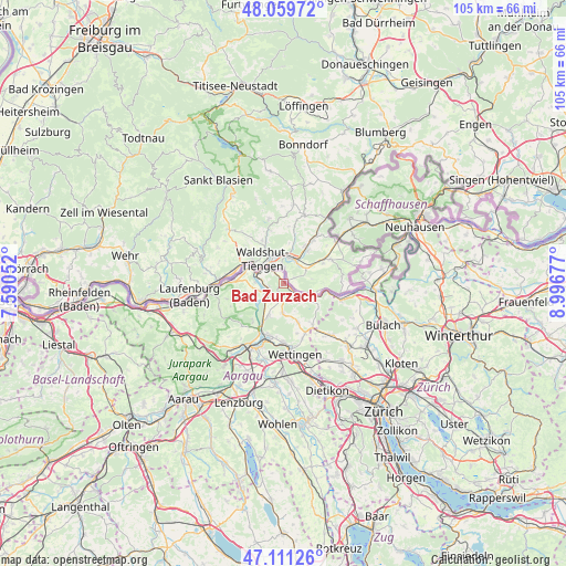
Bad Zurzach GPS coordinates[2]
47° 35' 15.504" North, 8° 17' 37.14" East
| Map corner | latitude | longitude |
|---|---|---|
| Upper-left | 48.05972°, | 7.59052° |
| Center: | 47.58764°, | 8.29365° |
| Lower-right: | 47.11126°, | 8.99677° |
| Map W x H: | 105.5×105.5 km | = 65.6×65.6mi |
| max Lat: | 47.76737° ⇑3.4% North |
| Bad Zurzach: | 47.58764° |
| min Lat: | ⇓96.6% South 45.83203° |
| min Long | Bad Zurzach | max Long |
| 5.97153° | 8.29365° | 10.44624° |
| W 46.7%⇐ | ⇒53.3% E |
Elevation
Elevation of Bad Zurzach is 345 m = 1132 ft, and this is 213.2 m = 699 ft below average elevation for this country.
| Max E: |
1845 m = 6053 ft | 95.4% |
| Avg. | 558.2 m = 1831 ft | |
| Bad Zurzach | 345 m = 1132 ft | |
Min E: |
197 m = 646 ft | 4.6% |
See also: Switzerland elevation on elevation.city.
Geographical zone
Bad Zurzach is located in North temperate zone (between Tropic of Cancer and the Arctic Circle). Distance of this North polar circle is 2109.9 km =1311 mi to North.| Distance of | km | miles | from Bad Zurzach |
|---|---|---|---|
| North Pole | 4715.8 | 2930.3 | to North |
| Arctic Circle | 2109.9 | 1311 | to North |
| Tropic Cancer | 2685.3 | 1668.6 | to South |
| Equator | 5291.2 | 3287.8 | to South |


Nearby cities:
15 places around Bad Zurzach: (largest is in red/bold)
• Ehrendingen
10.3 km =6.4 mi,  156°
156°
• Endingen
5.6 km =3.5 mi,  182°
182°
• Klingnau
3.4 km =2.1 mi,  262°
262°
• Koblenz
4.9 km =3 mi,  300°
300°
• Lauffohr (Brugg)
10.7 km =6.6 mi,  206°
206°
• Leibstadt
8.8 km =5.5 mi,  270°
270°
• Niederweningen / Niederweningen (Dorf)
11 km =6.8 mi,  145°
145°
• Rekingen
2.5 km =1.6 mi,  134°
134°
• Siglistorf
8 km =5 mi, 126°
• Tegerfelden
3.3 km =2.1 mi,  185°
185°
• Turgi
11 km =6.8 mi,  195°
195°
• Untersiggenthal
9.9 km =6.2 mi, 196°
• Villigen
9 km =5.6 mi,  221°
221°
• Weiach
11 km =6.8 mi,  106°
106°
• Würenlingen
6.6 km =4.1 mi, 204°
Sources, notices
• [Note1] Compared only with cities in Switzerland existing in our database
• [Src1] Map data: © OpenStreetMap contributors (CC-BY-SA)
• [Src2] Other city data from geonames.org with taken over terms of usage.
• [Src3] Geographical zone / Annual Mean Temperature by Robert A. Rohde @ Wikipedia
