Rekingen geodata
Rekingen (Aargau) is a populated place; located in Switzerland in Europe/Zurich (GMT+2) time zone. With population of 856 people, there are 1450 cities with bigger population in this country. Compared to other cities in Switzerland, 95.9% of cities are located further ↓South; 52.7% of cities are located further →East and 95.7% of cities have higher elevation than Rekingen. Note1


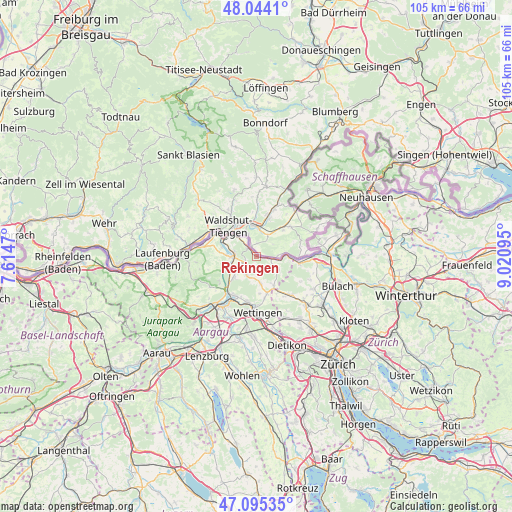
Rekingen GPS coordinates[2]
47° 34' 18.732" North, 8° 19' 4.152" East
| Map corner | latitude | longitude |
|---|---|---|
| Upper-left | 48.0441°, | 7.6147° |
| Center: | 47.57187°, | 8.31782° |
| Lower-right: | 47.09535°, | 9.02095° |
| Map W x H: | 105.5×105.5 km | = 65.6×65.6mi |
| max Lat: | 47.76737° ⇑4.1% North |
| Rekingen: | 47.57187° |
| min Lat: | ⇓95.9% South 45.83203° |
| min Long | Rekingen | max Long |
| 5.97153° | 8.31782° | 10.44624° |
| W 47.3%⇐ | ⇒52.7% E |
Elevation
Elevation of Rekingen is 340 m = 1115 ft, and this is 218.2 m = 716 ft below average elevation for this country.
| Max E: |
1845 m = 6053 ft | 95.7% |
| Avg. | 558.2 m = 1831 ft | |
| Rekingen | 340 m = 1115 ft | |
Min E: |
197 m = 646 ft | 4.3% |
See also: Switzerland elevation on elevation.city.
Geographical zone
Rekingen is located in North temperate zone (between Tropic of Cancer and the Arctic Circle). Distance of this North polar circle is 2111.7 km =1312.1 mi to North.| Distance of | km | miles | from Rekingen |
|---|---|---|---|
| North Pole | 4717.6 | 2931.4 | to North |
| Arctic Circle | 2111.7 | 1312.1 | to North |
| Tropic Cancer | 2683.6 | 1667.5 | to South |
| Equator | 5289.5 | 3286.7 | to South |


Nearby cities:
15 places around Rekingen: (largest is in red/bold)
• Bad Zurzach
2.5 km =1.6 mi,  314°
314°
• Ehrendingen
8 km =5 mi,  163°
163°
• Endingen
4.3 km =2.7 mi,  208°
208°
• Klingnau
5.3 km =3.3 mi,  284°
284°
• Koblenz
7.3 km =4.5 mi,  304°
304°
• Niederweningen / Niederweningen (Dorf)
8.6 km =5.3 mi,  148°
148°
• Obersiggenthal
9.5 km =5.9 mi,  189°
189°
• Siglistorf
5.5 km =3.4 mi,  123°
123°
• Tegerfelden
2.6 km =1.6 mi,  234°
234°
• Turgi
10.1 km =6.3 mi, 208°
• Untersiggenthal
9.1 km =5.7 mi, 211°
• Villigen
9.2 km =5.7 mi,  237°
237°
• Weiach
8.8 km =5.5 mi,  99°
99°
• Weiach / Weiach (Dorfkern)
9.2 km =5.7 mi, 100°
• Würenlingen
6.3 km =3.9 mi, 227°
Sources, notices
• [Note1] Compared only with cities in Switzerland existing in our database
• [Src1] Map data: © OpenStreetMap contributors (CC-BY-SA)
• [Src2] Other city data from geonames.org with taken over terms of usage.
• [Src3] Geographical zone / Annual Mean Temperature by Robert A. Rohde @ Wikipedia
