Zollikon geodata
Zollikon (Zurich) is a populated place; located in Switzerland in Europe/Zurich (GMT+2) time zone. With population of 5,812 people, there are 284 cities with bigger population in this country. Compared to other cities in Switzerland, 63.6% of cities are located further ↓South; 63.4% of cities are located further ←West and 54.2% of cities have higher elevation than Zollikon. Note1


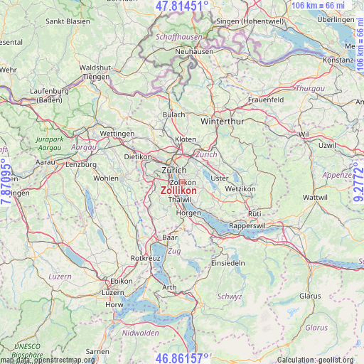
Zollikon GPS coordinates[2]
47° 20' 24.684" North, 8° 34' 26.652" East
| Map corner | latitude | longitude |
|---|---|---|
| Upper-left | 47.81451°, | 7.87095° |
| Center: | 47.34019°, | 8.57407° |
| Lower-right: | 46.86157°, | 9.2772° |
| Map W x H: | 106×106 km | = 65.9×65.9mi |
| max Lat: | 47.76737° ⇑36.4% North |
| Zollikon: | 47.34019° |
| min Lat: | ⇓63.6% South 45.83203° |
| min Long | Zollikon | max Long |
| 5.97153° | 8.57407° | 10.44624° |
| W 63.4%⇐ | ⇒36.6% E |
Elevation
Elevation of Zollikon is 469 m = 1539 ft, and this is 89.2 m = 293 ft below average elevation for this country.
| Max E: |
1845 m = 6053 ft | 54.2% |
| Avg. | 558.2 m = 1831 ft | |
| Zollikon | 469 m = 1539 ft | |
Min E: |
197 m = 646 ft | 45.8% |
See also: Switzerland elevation on elevation.city.
Geographical zone
Zollikon is located in North temperate zone (between Tropic of Cancer and the Arctic Circle). Distance of this North polar circle is 2137.4 km =1328.1 mi to North.| Distance of | km | miles | from Zollikon |
|---|---|---|---|
| North Pole | 4743.3 | 2947.3 | to North |
| Arctic Circle | 2137.4 | 1328.1 | to North |
| Tropic Cancer | 2657.8 | 1651.5 | to South |
| Equator | 5263.7 | 3270.7 | to South |


Nearby cities:
15 places around Zollikon: (largest is in red/bold)
• Kilchberg / Bendlikon
2.7 km =1.7 mi,  224°
224°
• Kilchberg / Hornhalden
2.6 km =1.6 mi,  247°
247°
• Küsnacht
2.6 km =1.6 mi,  163°
163°
• Küsnacht / Dorf
2.6 km =1.6 mi, 164°
• Küsnacht / Goldbach
1.5 km =0.9 mi, 160°
• Küsnacht / Itschnach
2.5 km =1.6 mi,  125°
125°
• Küsnacht / Schiedhalden
2.4 km =1.5 mi,  152°
152°
• Rebwies
1.2 km =0.7 mi,  49°
49°
• Zollikerberg
2.1 km =1.3 mi,  74°
74°
• Zürich (Kreis 7) / Hirslanden
2.5 km =1.6 mi,  348°
348°
• Zürich (Kreis 7) / Witikon
2.3 km =1.4 mi,  33°
33°
• Zürich (Kreis 8)
1.9 km =1.2 mi,  328°
328°
• Zürich (Kreis 8) / Mühlebach
2.3 km =1.4 mi, 326°
• Zürich (Kreis 8) / Seefeld
2.1 km =1.3 mi,  318°
318°
• Zürich (Kreis 8) / Weinegg
1.4 km =0.9 mi, 347°
Sources, notices
• [Note1] Compared only with cities in Switzerland existing in our database
• [Src1] Map data: © OpenStreetMap contributors (CC-BY-SA)
• [Src2] Other city data from geonames.org with taken over terms of usage.
• [Src3] Geographical zone / Annual Mean Temperature by Robert A. Rohde @ Wikipedia
