Küsnacht / Itschnach geodata
Küsnacht / Itschnach (Zurich) is a section of populated place; located in Switzerland in Europe/Zurich (GMT+1) time zone. With population of 2,397 people, there are 716 cities with bigger population in this country. Compared to other cities in Switzerland, 61.8% of cities are located further ↓South; 66.5% of cities are located further ←West and 71.5% of cities have lower elevation than Küsnacht / Itschnach. Note1


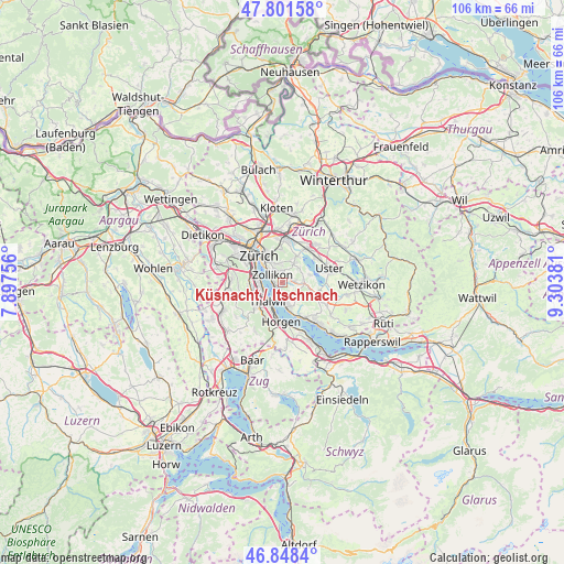
Küsnacht / Itschnach GPS coordinates[2]
47° 19' 37.704" North, 8° 36' 2.448" East
| Map corner | latitude | longitude |
|---|---|---|
| Upper-left | 47.80158°, | 7.89756° |
| Center: | 47.32714°, | 8.60068° |
| Lower-right: | 46.8484°, | 9.30381° |
| Map W x H: | 106×106 km | = 65.9×65.9mi |
| max Lat: | 47.76737° ⇑38.2% North |
| Küsnacht / Itschnach: | 47.32714° |
| min Lat: | ⇓61.8% South 45.83203° |
| min Long | Küsnacht / Its | max Long |
| 5.97153° | 8.60068° | 10.44624° |
| W 66.5%⇐ | ⇒33.5% E |
Elevation
Elevation of Küsnacht / Itschnach is 584 m = 1916 ft, and this is 25.8 m = 85 ft above average elevation for this country.
| Max E: |
1845 m = 6053 ft | 28.5% |
| Küsnacht / Itschnach | 584 m 1916 ft | |
| Avg. | 558.2 m = 1831 ft | |
Min E: |
197 m = 646 ft | 71.5% |
See also: Switzerland elevation on elevation.city.
Geographical zone
Küsnacht / Itschnach is located in North temperate zone (between Tropic of Cancer and the Arctic Circle). Distance of this North polar circle is 2138.9 km =1329.1 mi to North.| Distance of | km | miles | from Küsnacht / Itschnach |
|---|---|---|---|
| North Pole | 4744.8 | 2948.3 | to North |
| Arctic Circle | 2138.9 | 1329.1 | to North |
| Tropic Cancer | 2656.4 | 1650.6 | to South |
| Equator | 5262.3 | 3269.8 | to South |


Nearby cities:
15 places around Küsnacht / Itschnach: (largest is in red/bold)
• Erlenbach
2.7 km =1.7 mi,  185°
185°
• Erlenbach / links des Dorfbachs unterhalb Bahnlinie
3 km =1.9 mi, 188°
• Erlenbach / rechts des Dorfbachs oberhalb Bahnlinie
2.3 km =1.4 mi,  176°
176°
• Erlenbach / rechts des Dorfbachs unterhalb Bahnlinie
2.6 km =1.6 mi,  197°
197°
• Küsnacht
1.6 km =1 mi,  231°
231°
• Küsnacht / Allmend
1.4 km =0.9 mi, 190°
• Küsnacht / Dorf
1.7 km =1.1 mi, 232°
• Küsnacht / Goldbach
1.5 km =0.9 mi,  270°
270°
• Küsnacht / Heslibach
1.8 km =1.1 mi,  210°
210°
• Küsnacht / Schiedhalden
1.1 km =0.7 mi, 233°
• Rebwies
2.5 km =1.6 mi,  334°
334°
• Zollikerberg
2 km =1.2 mi,  0°
0°
• Zollikon
2.5 km =1.6 mi,  305°
305°
• Zumikon
1.7 km =1.1 mi,  73°
73°
• Zumikon / Fröschgüllen
1.5 km =0.9 mi,  46°
46°
Sources, notices
• [Note1] Compared only with cities in Switzerland existing in our database
• [Src1] Map data: © OpenStreetMap contributors (CC-BY-SA)
• [Src2] Other city data from geonames.org with taken over terms of usage.
• [Src3] Geographical zone / Annual Mean Temperature by Robert A. Rohde @ Wikipedia
