Zürich (Kreis 8) / Weinegg geodata
Zürich (Kreis 8) / Weinegg (Zurich) is a section of populated place; located in Switzerland in Europe/Zurich (GMT+2) time zone. With population of 4,951 people, there are 349 cities with bigger population in this country. Compared to other cities in Switzerland, 65% of cities are located further ↓South; 63.2% of cities are located further ←West and 52.7% of cities have higher elevation than Zürich (Kreis 8) / Weinegg. Note1
Current local time in Zürich (Kreis 8) / Weinegg:
07:40 AM, SaturdayDifference from your time zone: hours


Zürich (Kreis 8) / Weinegg GPS coordinates[2]
47° 21' 9" North, 8° 34' 12.396" East
| Map corner | latitude | longitude |
|---|---|---|
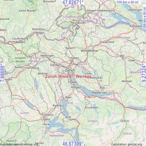
| Upper-left | 47.82671°, | 7.86699° |
| Center: | 47.3525°, | 8.57011° |
| Lower-right: | 46.87399°, | 9.27324° |
| Map W x H: | 105.9×105.9 km | = 65.8×65.8mi |
| max Lat: | 47.76737° ⇑35% North |
| Zürich (Kreis 8) / Weinegg: | 47.3525° |
| min Lat: | ⇓65% South 45.83203° |
| min Long | Zürich (Kreis | max Long |
| 5.97153° | 8.57011° | 10.44624° |
| W 63.2%⇐ | ⇒36.8% E |
Elevation
Elevation of Zürich (Kreis 8) / Weinegg is 472 m = 1549 ft, and this is 86.2 m = 283 ft below average elevation for this country.
| Max E: |
1845 m = 6053 ft | 52.7% |
| Avg. | 558.2 m = 1831 ft | |
| Zürich (Kreis 8) / Weinegg | 472 m = 1549 ft | |
Min E: |
197 m = 646 ft | 47.3% |
See also: Switzerland elevation on elevation.city.
Geographical zone
Zürich (Kreis 8) / Weinegg is located in North temperate zone (between Tropic of Cancer and the Arctic Circle). Distance of this North polar circle is 2136.1 km =1327.3 mi to North.| Distance of | km | miles | from Zürich (Kreis 8) / Weinegg |
|---|---|---|---|
| North Pole | 4742 | 2946.5 | to North |
| Arctic Circle | 2136.1 | 1327.3 | to North |
| Tropic Cancer | 2659.2 | 1652.3 | to South |
| Equator | 5265.1 | 3271.6 | to South |


Nearby cities:
15 places around Zürich (Kreis 8) / Weinegg: (largest is in red/bold)
• Küsnacht / Goldbach
2.9 km =1.8 mi,  164°
164°
• Rebwies
1.4 km =0.9 mi,  115°
115°
• Zollikerberg
2.5 km =1.6 mi,  109°
109°
• Zollikon
1.4 km =0.9 mi,  167°
167°
• Zürich
2.2 km =1.4 mi,  316°
316°
• Zürich (Kreis 1) / Hochschulen
2.4 km =1.5 mi,  309°
309°
• Zürich (Kreis 1) / Rathaus
2.8 km =1.7 mi, 318°
• Zürich (Kreis 7)
2.4 km =1.5 mi,  18°
18°
• Zürich (Kreis 7) / Hirslanden
1.1 km =0.7 mi,  350°
350°
• Zürich (Kreis 7) / Hottingen
2 km =1.2 mi,  344°
344°
• Zürich (Kreis 7) / Looren
2.2 km =1.4 mi,  54°
54°
• Zürich (Kreis 7) / Witikon
1.7 km =1.1 mi,  70°
70°
• Zürich (Kreis 8)
0.7 km =0.4 mi,  290°
290°
• Zürich (Kreis 8) / Mühlebach
1.1 km =0.7 mi,  299°
299°
• Zürich (Kreis 8) / Seefeld
1.1 km =0.7 mi,  281°
281°
Sources, notices
• [Note1] Compared only with cities in Switzerland existing in our database
• [Src1] Map data: © OpenStreetMap contributors (CC-BY-SA)
• [Src2] Other city data from geonames.org with taken over terms of usage.
• [Src3] Geographical zone / Annual Mean Temperature by Robert A. Rohde @ Wikipedia
