Rebwies geodata
Rebwies (Zurich) is a populated place; located in Switzerland in Europe/Zurich (GMT+2) time zone. With population of 897 people, there are 1418 cities with bigger population in this country. Compared to other cities in Switzerland, 64.2% of cities are located further ↓South; 64.8% of cities are located further ←West and 65.1% of cities have lower elevation than Rebwies. Note1


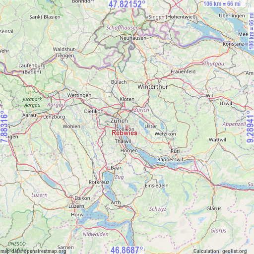
Rebwies GPS coordinates[2]
47° 20' 50.136" North, 8° 35' 10.644" East
| Map corner | latitude | longitude |
|---|---|---|
| Upper-left | 47.82152°, | 7.88316° |
| Center: | 47.34726°, | 8.58629° |
| Lower-right: | 46.8687°, | 9.28941° |
| Map W x H: | 105.9×105.9 km | = 65.8×65.8mi |
| max Lat: | 47.76737° ⇑35.8% North |
| Rebwies: | 47.34726° |
| min Lat: | ⇓64.2% South 45.83203° |
| min Long | Rebwies | max Long |
| 5.97153° | 8.58629° | 10.44624° |
| W 64.8%⇐ | ⇒35.2% E |
Elevation
Elevation of Rebwies is 547 m = 1795 ft, and this is 11.2 m = 37 ft below average elevation for this country.
| Max E: |
1845 m = 6053 ft | 34.9% |
| Avg. | 558.2 m = 1831 ft | |
| Rebwies | 547 m = 1795 ft | |
Min E: |
197 m = 646 ft | 65.1% |
See also: Switzerland elevation on elevation.city.
Geographical zone
Rebwies is located in North temperate zone (between Tropic of Cancer and the Arctic Circle). Distance of this North polar circle is 2136.7 km =1327.7 mi to North.| Distance of | km | miles | from Rebwies |
|---|---|---|---|
| North Pole | 4742.5 | 2946.9 | to North |
| Arctic Circle | 2136.7 | 1327.7 | to North |
| Tropic Cancer | 2658.6 | 1652 | to South |
| Equator | 5264.5 | 3271.2 | to South |


Nearby cities:
15 places around Rebwies: (largest is in red/bold)
• Küsnacht / Goldbach
2.3 km =1.4 mi,  190°
190°
• Küsnacht / Itschnach
2.5 km =1.6 mi,  154°
154°
• Küsnacht / Schiedhalden
2.9 km =1.8 mi,  176°
176°
• Zollikerberg
1.1 km =0.7 mi,  102°
102°
• Zollikon
1.2 km =0.7 mi,  229°
229°
• Zumikon / Fröschgüllen
2.5 km =1.6 mi,  118°
118°
• Zürich (Kreis 7)
2.9 km =1.8 mi,  351°
351°
• Zürich (Kreis 7) / Hirslanden
2.2 km =1.4 mi,  320°
320°
• Zürich (Kreis 7) / Hottingen
3.1 km =1.9 mi,  325°
325°
• Zürich (Kreis 7) / Looren
1.9 km =1.2 mi,  17°
17°
• Zürich (Kreis 7) / Witikon
1.2 km =0.7 mi, 17°
• Zürich (Kreis 8)
2.1 km =1.3 mi,  293°
293°
• Zürich (Kreis 8) / Mühlebach
2.4 km =1.5 mi,  297°
297°
• Zürich (Kreis 8) / Seefeld
2.5 km =1.6 mi, 289°
• Zürich (Kreis 8) / Weinegg
1.4 km =0.9 mi, 295°
Sources, notices
• [Note1] Compared only with cities in Switzerland existing in our database
• [Src1] Map data: © OpenStreetMap contributors (CC-BY-SA)
• [Src2] Other city data from geonames.org with taken over terms of usage.
• [Src3] Geographical zone / Annual Mean Temperature by Robert A. Rohde @ Wikipedia
