Zürich (Kreis 7) / Witikon geodata
Zürich (Kreis 7) / Witikon (Zurich) is a section of populated place; located in Switzerland in Europe/Zurich (GMT+2) time zone. With population of 9,099 people, there are 177 cities with bigger population in this country. Compared to other cities in Switzerland, 65.6% of cities are located further ↓South; 65.6% of cities are located further ←West and 73.1% of cities have lower elevation than Zürich (Kreis 7) / Witikon. Note1
Current local time in Zürich (Kreis 7) / Witikon:
07:40 AM, SaturdayDifference from your time zone: hours


Zürich (Kreis 7) / Witikon GPS coordinates[2]
47° 21' 27.036" North, 8° 35' 27.78" East
| Map corner | latitude | longitude |
|---|---|---|
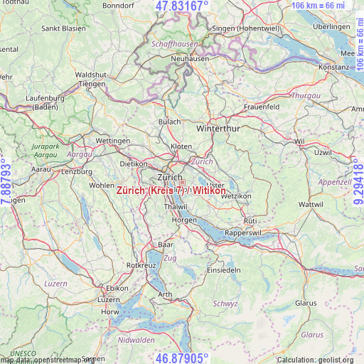
| Upper-left | 47.83167°, | 7.88793° |
| Center: | 47.35751°, | 8.59105° |
| Lower-right: | 46.87905°, | 9.29418° |
| Map W x H: | 105.9×105.9 km | = 65.8×65.8mi |
| max Lat: | 47.76737° ⇑34.4% North |
| Zürich (Kreis 7) / Witikon: | 47.35751° |
| min Lat: | ⇓65.6% South 45.83203° |
| min Long | Zürich (Kreis | max Long |
| 5.97153° | 8.59105° | 10.44624° |
| W 65.6%⇐ | ⇒34.4% E |
Elevation
Elevation of Zürich (Kreis 7) / Witikon is 599 m = 1965 ft, and this is 40.8 m = 134 ft above average elevation for this country.
| Max E: |
1845 m = 6053 ft | 26.9% |
| Zürich (Kreis 7) / Witikon | 599 m 1965 ft | |
| Avg. | 558.2 m = 1831 ft | |
Min E: |
197 m = 646 ft | 73.1% |
See also: Switzerland elevation on elevation.city.
Geographical zone
Zürich (Kreis 7) / Witikon is located in North temperate zone (between Tropic of Cancer and the Arctic Circle). Distance of this North polar circle is 2135.5 km =1326.9 mi to North.| Distance of | km | miles | from Zürich (Kreis 7) / Witikon |
|---|---|---|---|
| North Pole | 4741.4 | 2946.2 | to North |
| Arctic Circle | 2135.5 | 1326.9 | to North |
| Tropic Cancer | 2659.7 | 1652.7 | to South |
| Equator | 5265.7 | 3272 | to South |


Nearby cities:
15 places around Zürich (Kreis 7) / Witikon: (largest is in red/bold)
• Binz
2.7 km =1.7 mi,  92°
92°
• Gockhausen
2.7 km =1.7 mi,  14°
14°
• Gockhausen / Meisenrain
3 km =1.9 mi, 7°
• Pfaffhausen
2.6 km =1.6 mi,  71°
71°
• Rebwies
1.2 km =0.7 mi,  197°
197°
• Zollikerberg
1.6 km =1 mi,  151°
151°
• Zollikon
2.3 km =1.4 mi,  213°
213°
• Zürich (Kreis 7)
1.9 km =1.2 mi,  335°
335°
• Zürich (Kreis 7) / Hirslanden
1.9 km =1.2 mi,  287°
287°
• Zürich (Kreis 7) / Hottingen
2.5 km =1.6 mi,  303°
303°
• Zürich (Kreis 7) / Looren
0.8 km =0.5 mi,  16°
16°
• Zürich (Kreis 8)
2.3 km =1.4 mi,  262°
262°
• Zürich (Kreis 8) / Mühlebach
2.5 km =1.6 mi,  269°
269°
• Zürich (Kreis 8) / Seefeld
2.7 km =1.7 mi, 263°
• Zürich (Kreis 8) / Weinegg
1.7 km =1.1 mi,  250°
250°
Sources, notices
• [Note1] Compared only with cities in Switzerland existing in our database
• [Src1] Map data: © OpenStreetMap contributors (CC-BY-SA)
• [Src2] Other city data from geonames.org with taken over terms of usage.
• [Src3] Geographical zone / Annual Mean Temperature by Robert A. Rohde @ Wikipedia
