Wuppenau geodata
Wuppenau (Thurgau) is a populated place; located in Switzerland in Europe/Zurich (GMT+2) time zone. With population of 957 people, there are 1366 cities with bigger population in this country. Compared to other cities in Switzerland, 88.5% of cities are located further ↓South; 91.1% of cities are located further ←West and 75.1% of cities have lower elevation than Wuppenau. Note1


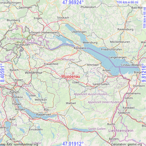
Wuppenau GPS coordinates[2]
47° 29' 46.788" North, 9° 6' 32.544" East
| Map corner | latitude | longitude |
|---|---|---|
| Upper-left | 47.96924°, | 8.40591° |
| Center: | 47.49633°, | 9.10904° |
| Lower-right: | 47.01912°, | 9.81216° |
| Map W x H: | 105.6×105.6 km | = 65.6×65.6mi |
| max Lat: | 47.76737° ⇑11.5% North |
| Wuppenau: | 47.49633° |
| min Lat: | ⇓88.5% South 45.83203° |
| min Long | Wuppenau | max Long |
| 5.97153° | 9.10904° | 10.44624° |
| W 91.1%⇐ | ⇒8.9% E |
Elevation
Elevation of Wuppenau is 618 m = 2028 ft, and this is 59.8 m = 196 ft above average elevation for this country.
| Max E: |
1845 m = 6053 ft | 24.9% |
| Wuppenau | 618 m 2028 ft | |
| Avg. | 558.2 m = 1831 ft | |
Min E: |
197 m = 646 ft | 75.1% |
See also: Switzerland elevation on elevation.city.
Geographical zone
Wuppenau is located in North temperate zone (between Tropic of Cancer and the Arctic Circle). Distance of this North polar circle is 2120.1 km =1317.4 mi to North.| Distance of | km | miles | from Wuppenau |
|---|---|---|---|
| North Pole | 4726 | 2936.6 | to North |
| Arctic Circle | 2120.1 | 1317.4 | to North |
| Tropic Cancer | 2675.2 | 1662.3 | to South |
| Equator | 5281.1 | 3281.5 | to South |


Nearby cities:
15 places around Wuppenau: (largest is in red/bold)
• Affeltrangen
6.6 km =4.1 mi,  299°
299°
• Bronschhofen
5.9 km =3.7 mi,  250°
250°
• Bürglen
6.6 km =4.1 mi,  27°
27°
• Jonschwil
8.2 km =5.1 mi,  191°
191°
• Münchwilen
8.7 km =5.4 mi,  255°
255°
• Niederbüren
8 km =5 mi,  115°
115°
• Niederhelfenschwil
6.2 km =3.9 mi,  112°
112°
• Oberuzwil
7.4 km =4.6 mi,  169°
169°
• Rickenbach bei Wil
7 km =4.3 mi,  220°
220°
• Schönholzerswilen
3.3 km =2.1 mi,  46°
46°
• Sulgen
7.5 km =4.7 mi, 50°
• Uzwil
6.9 km =4.3 mi,  164°
164°
• Weinfelden
7.9 km =4.9 mi,  355°
355°
• Wil
6.1 km =3.8 mi,  230°
230°
• Zuzwil
2.4 km =1.5 mi, 174°
Sources, notices
• [Note1] Compared only with cities in Switzerland existing in our database
• [Src1] Map data: © OpenStreetMap contributors (CC-BY-SA)
• [Src2] Other city data from geonames.org with taken over terms of usage.
• [Src3] Geographical zone / Annual Mean Temperature by Robert A. Rohde @ Wikipedia
