Schönholzerswilen geodata
Schönholzerswilen (Thurgau) is a populated place; located in Switzerland in Europe/Zurich (GMT+2) time zone. With population of 728 people, there are 1564 cities with bigger population in this country. Compared to other cities in Switzerland, 91.7% of cities are located further ↓South; 91.9% of cities are located further ←West and 67.7% of cities have lower elevation than Schönholzerswilen. Note1
Administrative division(s):
- Level 1: Thurgau
- Level 2: Weinfelden District
- Level 3: Schönholzerswilen


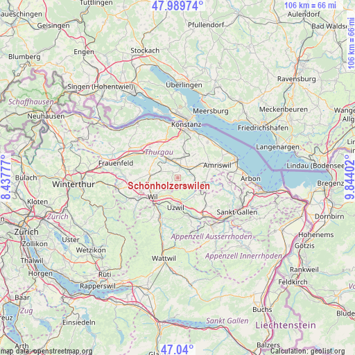
Schönholzerswilen GPS coordinates[2]
47° 31' 1.272" North, 9° 8' 27.204" East
| Map corner | latitude | longitude |
|---|---|---|
| Upper-left | 47.98974°, | 8.43777° |
| Center: | 47.51702°, | 9.14089° |
| Lower-right: | 47.04°, | 9.84402° |
| Map W x H: | 105.6×105.6 km | = 65.6×65.6mi |
| max Lat: | 47.76737° ⇑8.3% North |
| Schönholzerswilen: | 47.51702° |
| min Lat: | ⇓91.7% South 45.83203° |
| min Long | Schönholzerswi | max Long |
| 5.97153° | 9.14089° | 10.44624° |
| W 91.9%⇐ | ⇒8.1% E |
Elevation
Elevation of Schönholzerswilen is 560 m = 1837 ft, and this is 1.8 m = 6 ft above average elevation for this country.
| Max E: |
1845 m = 6053 ft | 32.3% |
| Schönholzerswilen | 560 m 1837 ft | |
| Avg. | 558.2 m = 1831 ft | |
Min E: |
197 m = 646 ft | 67.7% |
See also: Switzerland elevation on elevation.city.
Geographical zone
Schönholzerswilen is located in North temperate zone (between Tropic of Cancer and the Arctic Circle). Distance of this North polar circle is 2117.8 km =1315.9 mi to North.| Distance of | km | miles | from Schönholzerswilen |
|---|---|---|---|
| North Pole | 4723.7 | 2935.2 | to North |
| Arctic Circle | 2117.8 | 1315.9 | to North |
| Tropic Cancer | 2677.5 | 1663.7 | to South |
| Equator | 5283.4 | 3283 | to South |


Nearby cities:
15 places around Schönholzerswilen: (largest is in red/bold)
• Affeltrangen
8.2 km =5.1 mi,  276°
276°
• Berg
7.1 km =4.4 mi,  15°
15°
• Bronschhofen
9.1 km =5.7 mi,  241°
241°
• Bürglen
3.6 km =2.2 mi,  10°
10°
• Erlen
7.8 km =4.8 mi,  63°
63°
• Hohentannen
6.4 km =4 mi,  98°
98°
• Niederbüren
7.5 km =4.7 mi,  139°
139°
• Niederhelfenschwil
5.8 km =3.6 mi, 144°
• Oberuzwil
9.6 km =6 mi,  186°
186°
• Sulgen
4.2 km =2.6 mi,  53°
53°
• Uzwil
9 km =5.6 mi,  183°
183°
• Weinfelden
6.3 km =3.9 mi,  330°
330°
• Wil
9.5 km =5.9 mi,  229°
229°
• Wuppenau
3.3 km =2.1 mi, 226°
• Zuzwil
5.2 km =3.2 mi,  204°
204°
Sources, notices
• [Note1] Compared only with cities in Switzerland existing in our database
• [Src1] Map data: © OpenStreetMap contributors (CC-BY-SA)
• [Src2] Other city data from geonames.org with taken over terms of usage.
• [Src3] Geographical zone / Annual Mean Temperature by Robert A. Rohde @ Wikipedia
