Binz geodata
Binz (Zurich) is a populated place; located in Switzerland in Europe/Zurich (GMT+2) time zone. With population of 1,601 people, there are 981 cities with bigger population in this country. Compared to other cities in Switzerland, 65.3% of cities are located further ↓South; 68.6% of cities are located further ←West and 76.9% of cities have lower elevation than Binz. Note1


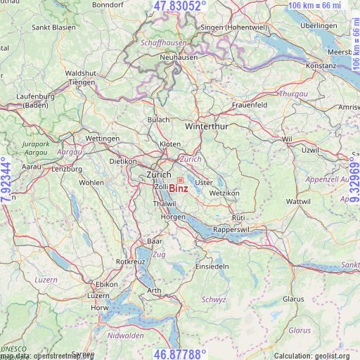
Binz GPS coordinates[2]
47° 21' 22.86" North, 8° 37' 35.652" East
| Map corner | latitude | longitude |
|---|---|---|
| Upper-left | 47.83052°, | 7.92344° |
| Center: | 47.35635°, | 8.62657° |
| Lower-right: | 46.87788°, | 9.32969° |
| Map W x H: | 105.9×105.9 km | = 65.8×65.8mi |
| max Lat: | 47.76737° ⇑34.7% North |
| Binz: | 47.35635° |
| min Lat: | ⇓65.3% South 45.83203° |
| min Long | Binz | max Long |
| 5.97153° | 8.62657° | 10.44624° |
| W 68.6%⇐ | ⇒31.4% E |
Elevation
Elevation of Binz is 633 m = 2077 ft, and this is 74.8 m = 245 ft above average elevation for this country.
| Max E: |
1845 m = 6053 ft | 23.1% |
| Binz | 633 m 2077 ft | |
| Avg. | 558.2 m = 1831 ft | |
Min E: |
197 m = 646 ft | 76.9% |
See also: Switzerland elevation on elevation.city.
Geographical zone
Binz is located in North temperate zone (between Tropic of Cancer and the Arctic Circle). Distance of this North polar circle is 2135.6 km =1327 mi to North.| Distance of | km | miles | from Binz |
|---|---|---|---|
| North Pole | 4741.5 | 2946.2 | to North |
| Arctic Circle | 2135.6 | 1327 | to North |
| Tropic Cancer | 2659.6 | 1652.6 | to South |
| Equator | 5265.5 | 3271.8 | to South |


Nearby cities:
15 places around Binz: (largest is in red/bold)
• Benglen
0.9 km =0.6 mi,  57°
57°
• Ebmatingen
1.3 km =0.8 mi,  125°
125°
• Ebmatingen / Bachtobel
1.2 km =0.7 mi,  111°
111°
• Ebmatingen / Lebern
1.5 km =0.9 mi, 125°
• Fällanden
1.9 km =1.2 mi,  28°
28°
• Gockhausen
3.4 km =2.1 mi,  323°
323°
• Pfaffhausen
1 km =0.6 mi,  347°
347°
• Rebwies
3.2 km =2 mi,  251°
251°
• Schwerzenbach / Blatten
3.4 km =2.1 mi, 30°
• Schwerzenbach / Widacher
3.6 km =2.2 mi,  39°
39°
• Zollikerberg
2.3 km =1.4 mi,  237°
237°
• Zumikon
2.8 km =1.7 mi,  186°
186°
• Zumikon / Fröschgüllen
2.4 km =1.5 mi,  201°
201°
• Zürich (Kreis 7) / Looren
2.6 km =1.6 mi,  289°
289°
• Zürich (Kreis 7) / Witikon
2.7 km =1.7 mi,  272°
272°
Sources, notices
• [Note1] Compared only with cities in Switzerland existing in our database
• [Src1] Map data: © OpenStreetMap contributors (CC-BY-SA)
• [Src2] Other city data from geonames.org with taken over terms of usage.
• [Src3] Geographical zone / Annual Mean Temperature by Robert A. Rohde @ Wikipedia
