Walzenhausen geodata
Walzenhausen (Appenzell Ausserrhoden) is a populated place; located in Switzerland in Europe/Zurich (GMT+2) time zone. With population of 2,120 people, there are 803 cities with bigger population in this country. Compared to other cities in Switzerland, 82.1% of cities are located further ↓South; 98.3% of cities are located further ←West and 82.8% of cities have lower elevation than Walzenhausen. Note1
Administrative division(s):
- Level 1: Appenzell Ausserrhoden
- Level 2: Bezirk Vorderland
- Level 3: Walzenhausen


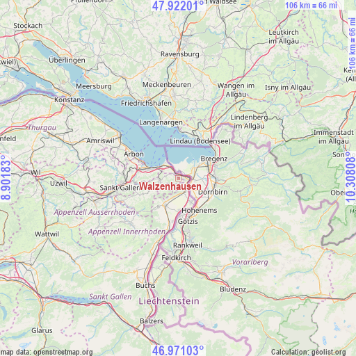
Walzenhausen GPS coordinates[2]
47° 26' 55.212" North, 9° 36' 17.82" East
| Map corner | latitude | longitude |
|---|---|---|
| Upper-left | 47.92201°, | 8.90183° |
| Center: | 47.44867°, | 9.60495° |
| Lower-right: | 46.97103°, | 10.30808° |
| Map W x H: | 105.7×105.7 km | = 65.7×65.7mi |
| max Lat: | 47.76737° ⇑17.9% North |
| Walzenhausen: | 47.44867° |
| min Lat: | ⇓82.1% South 45.83203° |
| min Long | Walzenhausen | max Long |
| 5.97153° | 9.60495° | 10.44624° |
| W 98.3%⇐ | ⇒1.7% E |
Elevation
Elevation of Walzenhausen is 704 m = 2310 ft, and this is 145.8 m = 478 ft above average elevation for this country.
| Max E: |
1845 m = 6053 ft | 17.2% |
| Walzenhausen | 704 m 2310 ft | |
| Avg. | 558.2 m = 1831 ft | |
Min E: |
197 m = 646 ft | 82.8% |
See also: Switzerland elevation on elevation.city.
Geographical zone
Walzenhausen is located in North temperate zone (between Tropic of Cancer and the Arctic Circle). Distance of this North polar circle is 2125.4 km =1320.7 mi to North.| Distance of | km | miles | from Walzenhausen |
|---|---|---|---|
| North Pole | 4731.3 | 2939.9 | to North |
| Arctic Circle | 2125.4 | 1320.7 | to North |
| Tropic Cancer | 2669.9 | 1659 | to South |
| Equator | 5275.8 | 3278.2 | to South |


Nearby cities:
15 places around Walzenhausen: (largest is in red/bold)
• Altstätten
9 km =5.6 mi,  208°
208°
• Au
3 km =1.9 mi,  131°
131°
• Balgach
4.8 km =3 mi,  178°
178°
• Diepoldsau
7.9 km =4.9 mi,  151°
151°
• Eggersriet
10.2 km =6.3 mi,  265°
265°
• Goldach
10.7 km =6.6 mi,  285°
285°
• Heiden
5.5 km =3.4 mi,  262°
262°
• Oberegg
4.8 km =3 mi,  237°
237°
• Rebstein
5.8 km =3.6 mi,  194°
194°
• Rehetobel
9.5 km =5.9 mi,  254°
254°
• Rheineck
2.2 km =1.4 mi,  330°
330°
• Rorschach
9.2 km =5.7 mi, 290°
• Sankt Margrethen
2.5 km =1.6 mi,  80°
80°
• Thal
3.5 km =2.2 mi,  304°
304°
• Trogen
11.5 km =7.1 mi, 246°
Sources, notices
• [Note1] Compared only with cities in Switzerland existing in our database
• [Src1] Map data: © OpenStreetMap contributors (CC-BY-SA)
• [Src2] Other city data from geonames.org with taken over terms of usage.
• [Src3] Geographical zone / Annual Mean Temperature by Robert A. Rohde @ Wikipedia
