Rheineck geodata
Rheineck (Saint Gallen) is a populated place; located in Switzerland in Europe/Zurich (GMT+2) time zone. With population of 3,298 people, there are 530 cities with bigger population in this country. Compared to other cities in Switzerland, 84.5% of cities are located further ↓South; 98.1% of cities are located further ←West and 87.8% of cities have higher elevation than Rheineck. Note1


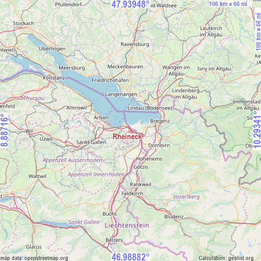
Rheineck GPS coordinates[2]
47° 27' 58.68" North, 9° 35' 25.008" East
| Map corner | latitude | longitude |
|---|---|---|
| Upper-left | 47.93948°, | 8.88716° |
| Center: | 47.4663°, | 9.59028° |
| Lower-right: | 46.98882°, | 10.29341° |
| Map W x H: | 105.7×105.7 km | = 65.7×65.7mi |
| max Lat: | 47.76737° ⇑15.5% North |
| Rheineck: | 47.4663° |
| min Lat: | ⇓84.5% South 45.83203° |
| min Long | Rheineck | max Long |
| 5.97153° | 9.59028° | 10.44624° |
| W 98.1%⇐ | ⇒1.9% E |
Elevation
Elevation of Rheineck is 403 m = 1322 ft, and this is 155.2 m = 509 ft below average elevation for this country.
| Max E: |
1845 m = 6053 ft | 87.8% |
| Avg. | 558.2 m = 1831 ft | |
| Rheineck | 403 m = 1322 ft | |
Min E: |
197 m = 646 ft | 12.2% |
See also: Switzerland elevation on elevation.city.
Geographical zone
Rheineck is located in North temperate zone (between Tropic of Cancer and the Arctic Circle). Distance of this North polar circle is 2123.4 km =1319.4 mi to North.| Distance of | km | miles | from Rheineck |
|---|---|---|---|
| North Pole | 4729.3 | 2938.6 | to North |
| Arctic Circle | 2123.4 | 1319.4 | to North |
| Tropic Cancer | 2671.8 | 1660.2 | to South |
| Equator | 5277.8 | 3279.5 | to South |


Nearby cities:
15 places around Rheineck: (largest is in red/bold)
• Altstätten
10.4 km =6.5 mi,  198°
198°
• Au
5.1 km =3.2 mi,  139°
139°
• Balgach
6.9 km =4.3 mi,  169°
169°
• Diepoldsau
10.2 km =6.3 mi,  151°
151°
• Eggersriet
9.5 km =5.9 mi,  253°
253°
• Goldach
9.3 km =5.8 mi,  275°
275°
• Heiden
5.1 km =3.2 mi,  238°
238°
• Horn
10.1 km =6.3 mi,  287°
287°
• Oberegg
5.4 km =3.4 mi,  212°
212°
• Rebstein
7.6 km =4.7 mi,  182°
182°
• Rehetobel
9.2 km =5.7 mi, 241°
• Rorschach
7.6 km =4.7 mi, 279°
• Sankt Margrethen
3.9 km =2.4 mi,  113°
113°
• Thal
1.8 km =1.1 mi,  271°
271°
• Walzenhausen
2.2 km =1.4 mi, 150°
Sources, notices
• [Note1] Compared only with cities in Switzerland existing in our database
• [Src1] Map data: © OpenStreetMap contributors (CC-BY-SA)
• [Src2] Other city data from geonames.org with taken over terms of usage.
• [Src3] Geographical zone / Annual Mean Temperature by Robert A. Rohde @ Wikipedia
