Altstätten geodata
Altstätten (Saint Gallen) is a populated place; located in Switzerland in Europe/Zurich (GMT+2) time zone. With population of 10,574 people, there are 129 cities with bigger population in this country. Compared to other cities in Switzerland, 68.8% of cities are located further ↓South; 97.4% of cities are located further ←West and 64.5% of cities have higher elevation than Altstätten. Note1


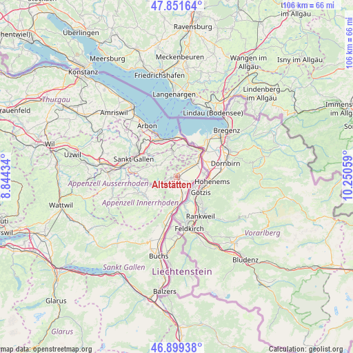
Altstätten GPS coordinates[2]
47° 22' 39.576" North, 9° 32' 50.856" East
| Map corner | latitude | longitude |
|---|---|---|
| Upper-left | 47.85164°, | 8.84434° |
| Center: | 47.37766°, | 9.54746° |
| Lower-right: | 46.89938°, | 10.25059° |
| Map W x H: | 105.9×105.9 km | = 65.8×65.8mi |
| max Lat: | 47.76737° ⇑31.2% North |
| Altstätten: | 47.37766° |
| min Lat: | ⇓68.8% South 45.83203° |
| min Long | Altstätten | max Long |
| 5.97153° | 9.54746° | 10.44624° |
| W 97.4%⇐ | ⇒2.6% E |
Elevation
Elevation of Altstätten is 447 m = 1467 ft, and this is 111.2 m = 365 ft below average elevation for this country.
| Max E: |
1845 m = 6053 ft | 64.5% |
| Avg. | 558.2 m = 1831 ft | |
| Altstätten | 447 m = 1467 ft | |
Min E: |
197 m = 646 ft | 35.5% |
See also: Switzerland elevation on elevation.city.
Geographical zone
Altstätten is located in North temperate zone (between Tropic of Cancer and the Arctic Circle). Distance of this North polar circle is 2133.3 km =1325.6 mi to North.| Distance of | km | miles | from Altstätten |
|---|---|---|---|
| North Pole | 4739.2 | 2944.8 | to North |
| Arctic Circle | 2133.3 | 1325.6 | to North |
| Tropic Cancer | 2662 | 1654.1 | to South |
| Equator | 5267.9 | 3273.3 | to South |


Nearby cities:
15 places around Altstätten: (largest is in red/bold)
• Au
8.8 km =5.5 mi,  47°
47°
• Balgach
5.5 km =3.4 mi,  55°
55°
• Bühler
9.2 km =5.7 mi,  267°
267°
• Diepoldsau
8.2 km =5.1 mi,  83°
83°
• Eichberg
4 km =2.5 mi,  197°
197°
• Gais
7.3 km =4.5 mi,  255°
255°
• Heiden
7.3 km =4.5 mi,  351°
351°
• Oberegg
5.3 km =3.3 mi,  3°
3°
• Oberriet
6.5 km =4 mi,  166°
166°
• Rebstein
3.6 km =2.2 mi, 51°
• Rehetobel
7.2 km =4.5 mi,  317°
317°
• Rüthi
9.2 km =5.7 mi,  184°
184°
• Speicher
8.7 km =5.4 mi,  295°
295°
• Trogen
7.1 km =4.4 mi, 298°
• Walzenhausen
9 km =5.6 mi,  28°
28°
Sources, notices
• [Note1] Compared only with cities in Switzerland existing in our database
• [Src1] Map data: © OpenStreetMap contributors (CC-BY-SA)
• [Src2] Other city data from geonames.org with taken over terms of usage.
• [Src3] Geographical zone / Annual Mean Temperature by Robert A. Rohde @ Wikipedia
