Diepoldsau geodata
Diepoldsau (Saint Gallen) is a populated place; located in Switzerland in Europe/Zurich (GMT+2) time zone. With population of 5,401 people, there are 312 cities with bigger population in this country. Compared to other cities in Switzerland, 70.3% of cities are located further ↓South; 98.6% of cities are located further ←West and 84.6% of cities have higher elevation than Diepoldsau. Note1


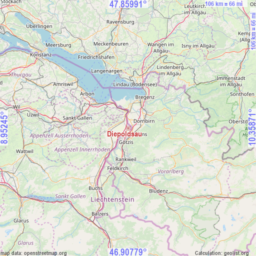
Diepoldsau GPS coordinates[2]
47° 23' 9.6" North, 9° 39' 20.088" East
| Map corner | latitude | longitude |
|---|---|---|
| Upper-left | 47.85991°, | 8.95245° |
| Center: | 47.386°, | 9.65558° |
| Lower-right: | 46.90779°, | 10.35871° |
| Map W x H: | 105.9×105.9 km | = 65.8×65.8mi |
| max Lat: | 47.76737° ⇑29.7% North |
| Diepoldsau: | 47.386° |
| min Lat: | ⇓70.3% South 45.83203° |
| min Long | Diepoldsau | max Long |
| 5.97153° | 9.65558° | 10.44624° |
| W 98.6%⇐ | ⇒1.4% E |
Elevation
Elevation of Diepoldsau is 411 m = 1348 ft, and this is 147.2 m = 483 ft below average elevation for this country.
| Max E: |
1845 m = 6053 ft | 84.6% |
| Avg. | 558.2 m = 1831 ft | |
| Diepoldsau | 411 m = 1348 ft | |
Min E: |
197 m = 646 ft | 15.4% |
See also: Switzerland elevation on elevation.city.
Geographical zone
Diepoldsau is located in North temperate zone (between Tropic of Cancer and the Arctic Circle). Distance of this North polar circle is 2132.3 km =1324.9 mi to North.| Distance of | km | miles | from Diepoldsau |
|---|---|---|---|
| North Pole | 4738.2 | 2944.2 | to North |
| Arctic Circle | 2132.3 | 1324.9 | to North |
| Tropic Cancer | 2662.9 | 1654.6 | to South |
| Equator | 5268.8 | 3273.9 | to South |


Nearby cities:
15 places around Diepoldsau: (largest is in red/bold)
• Altstätten
8.2 km =5.1 mi,  263°
263°
• Au
5.2 km =3.2 mi,  342°
342°
• Balgach
4.3 km =2.7 mi,  300°
300°
• Eichberg
10.5 km =6.5 mi,  243°
243°
• Heiden
11.2 km =7 mi, 304°
• Oberegg
9 km =5.6 mi, 299°
• Oberriet
9.8 km =6.1 mi,  222°
222°
• Rebstein
5.5 km =3.4 mi,  284°
284°
• Rehetobel
13.7 km =8.5 mi,  288°
288°
• Rheineck
10.2 km =6.3 mi,  331°
331°
• Rüthi
13.4 km =8.3 mi, 221°
• Sankt Margrethen
7.5 km =4.7 mi,  349°
349°
• Thal
11.2 km =7 mi,  323°
323°
• Trogen
14.5 km =9 mi, 279°
• Walzenhausen
7.9 km =4.9 mi, 331°
Sources, notices
• [Note1] Compared only with cities in Switzerland existing in our database
• [Src1] Map data: © OpenStreetMap contributors (CC-BY-SA)
• [Src2] Other city data from geonames.org with taken over terms of usage.
• [Src3] Geographical zone / Annual Mean Temperature by Robert A. Rohde @ Wikipedia
