Waldkirch geodata
Waldkirch (Saint Gallen) is a populated place; located in Switzerland in Europe/Zurich (GMT+2) time zone. With population of 3,137 people, there are 563 cities with bigger population in this country. Compared to other cities in Switzerland, 84.7% of cities are located further ↓South; 94% of cities are located further ←West and 76.1% of cities have lower elevation than Waldkirch. Note1


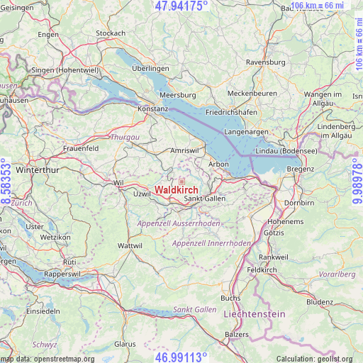
Waldkirch GPS coordinates[2]
47° 28' 6.924" North, 9° 17' 11.94" East
| Map corner | latitude | longitude |
|---|---|---|
| Upper-left | 47.94175°, | 8.58353° |
| Center: | 47.46859°, | 9.28665° |
| Lower-right: | 46.99113°, | 9.98978° |
| Map W x H: | 105.7×105.7 km | = 65.7×65.7mi |
| max Lat: | 47.76737° ⇑15.3% North |
| Waldkirch: | 47.46859° |
| min Lat: | ⇓84.7% South 45.83203° |
| min Long | Waldkirch | max Long |
| 5.97153° | 9.28665° | 10.44624° |
| W 94%⇐ | ⇒6% E |
Elevation
Elevation of Waldkirch is 627 m = 2057 ft, and this is 68.8 m = 226 ft above average elevation for this country.
| Max E: |
1845 m = 6053 ft | 23.9% |
| Waldkirch | 627 m 2057 ft | |
| Avg. | 558.2 m = 1831 ft | |
Min E: |
197 m = 646 ft | 76.1% |
See also: Switzerland elevation on elevation.city.
Geographical zone
Waldkirch is located in North temperate zone (between Tropic of Cancer and the Arctic Circle). Distance of this North polar circle is 2123.2 km =1319.3 mi to North.| Distance of | km | miles | from Waldkirch |
|---|---|---|---|
| North Pole | 4729 | 2938.5 | to North |
| Arctic Circle | 2123.2 | 1319.3 | to North |
| Tropic Cancer | 2672.1 | 1660.4 | to South |
| Equator | 5278 | 3279.6 | to South |


Nearby cities:
15 places around Waldkirch: (largest is in red/bold)
• Abtwil
5.6 km =3.5 mi,  152°
152°
• Amriswil
8.7 km =5.4 mi,  4°
4°
• Andwil
3.5 km =2.2 mi,  195°
195°
• Erlen
9.7 km =6 mi,  335°
335°
• Flawil
9.9 km =6.2 mi,  231°
231°
• Gossau
6.4 km =4 mi, 202°
• Herisau
9.2 km =5.7 mi,  183°
183°
• Hohentannen
6.4 km =4 mi,  313°
313°
• Häggenschwil
5.2 km =3.2 mi,  56°
56°
• Muolen
6.5 km =4 mi,  26°
26°
• Niederbüren
6.1 km =3.8 mi,  266°
266°
• Niederhelfenschwil
7.6 km =4.7 mi,  275°
275°
• Roggwil
8.9 km =5.5 mi,  67°
67°
• Sankt Gallen
8.3 km =5.2 mi,  126°
126°
• Wittenbach
7.5 km =4.7 mi,  96°
96°
Sources, notices
• [Note1] Compared only with cities in Switzerland existing in our database
• [Src1] Map data: © OpenStreetMap contributors (CC-BY-SA)
• [Src2] Other city data from geonames.org with taken over terms of usage.
• [Src3] Geographical zone / Annual Mean Temperature by Robert A. Rohde @ Wikipedia
