Hohentannen geodata
Hohentannen (Thurgau) is a seat of a third-order administrative division; located in Switzerland in Europe/Zurich (GMT+2) time zone. In our database, there are 1823 cities with bigger population. Compared to other cities in Switzerland, 90.6% of cities are located further ↓South; 93.1% of cities are located further ←West and 70.5% of cities have lower elevation than Hohentannen. Note1


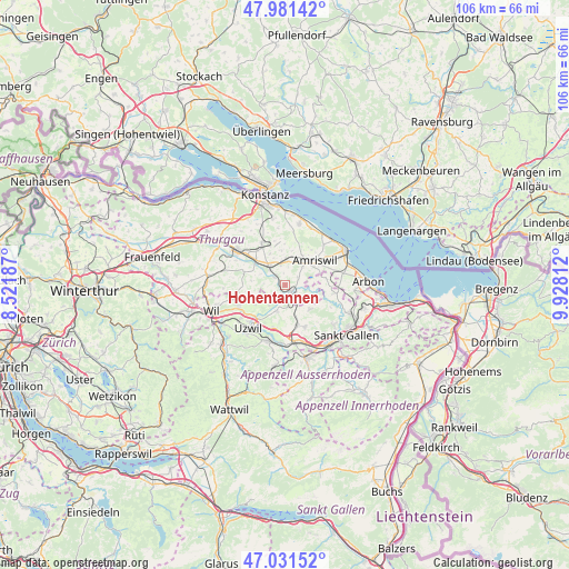
Hohentannen GPS coordinates[2]
47° 30' 31.032" North, 9° 13' 30" East
| Map corner | latitude | longitude |
|---|---|---|
| Upper-left | 47.98142°, | 8.52187° |
| Center: | 47.50862°, | 9.225° |
| Lower-right: | 47.03152°, | 9.92812° |
| Map W x H: | 105.6×105.6 km | = 65.6×65.6mi |
| max Lat: | 47.76737° ⇑9.4% North |
| Hohentannen: | 47.50862° |
| min Lat: | ⇓90.6% South 45.83203° |
| min Long | Hohentannen | max Long |
| 5.97153° | 9.225° | 10.44624° |
| W 93.1%⇐ | ⇒6.9% E |
Elevation
Elevation of Hohentannen is 574 m = 1883 ft, and this is 15.8 m = 52 ft above average elevation for this country.
| Max E: |
1845 m = 6053 ft | 29.5% |
| Hohentannen | 574 m 1883 ft | |
| Avg. | 558.2 m = 1831 ft | |
Min E: |
197 m = 646 ft | 70.5% |
See also: Switzerland elevation on elevation.city.
Geographical zone
Hohentannen is located in North temperate zone (between Tropic of Cancer and the Arctic Circle). Distance of this North polar circle is 2118.7 km =1316.5 mi to North.| Distance of | km | miles | from Hohentannen |
|---|---|---|---|
| North Pole | 4724.6 | 2935.7 | to North |
| Arctic Circle | 2118.7 | 1316.5 | to North |
| Tropic Cancer | 2676.5 | 1663.1 | to South |
| Equator | 5282.5 | 3282.4 | to South |


Nearby cities:
15 places around Hohentannen: (largest is in red/bold)
• Amriswil
6.8 km =4.2 mi,  51°
51°
• Andwil
8.6 km =5.3 mi,  154°
154°
• Berg
9 km =5.6 mi,  330°
330°
• Bürglen
7.2 km =4.5 mi,  308°
308°
• Erlen
4.4 km =2.7 mi,  8°
8°
• Häggenschwil
9.1 km =5.7 mi,  99°
99°
• Langrickenbach
9.6 km =6 mi, 10°
• Muolen
7.6 km =4.7 mi,  79°
79°
• Niederbüren
5 km =3.1 mi,  196°
196°
• Niederhelfenschwil
4.8 km =3 mi,  218°
218°
• Schönholzerswilen
6.4 km =4 mi,  278°
278°
• Sulgen
4.5 km =2.8 mi,  319°
319°
• Waldkirch
6.4 km =4 mi,  133°
133°
• Wuppenau
8.8 km =5.5 mi,  261°
261°
• Zuzwil
9.3 km =5.8 mi,  245°
245°
Sources, notices
• [Note1] Compared only with cities in Switzerland existing in our database
• [Src1] Map data: © OpenStreetMap contributors (CC-BY-SA)
• [Src2] Other city data from geonames.org with taken over terms of usage.
• [Src3] Geographical zone / Annual Mean Temperature by Robert A. Rohde @ Wikipedia
