Muolen geodata
Muolen (Saint Gallen) is a populated place; located in Switzerland in Europe/Zurich (GMT+2) time zone. With population of 1,118 people, there are 1254 cities with bigger population in this country. Compared to other cities in Switzerland, 92.3% of cities are located further ↓South; 94.4% of cities are located further ←West and 53.9% of cities have lower elevation than Muolen. Note1


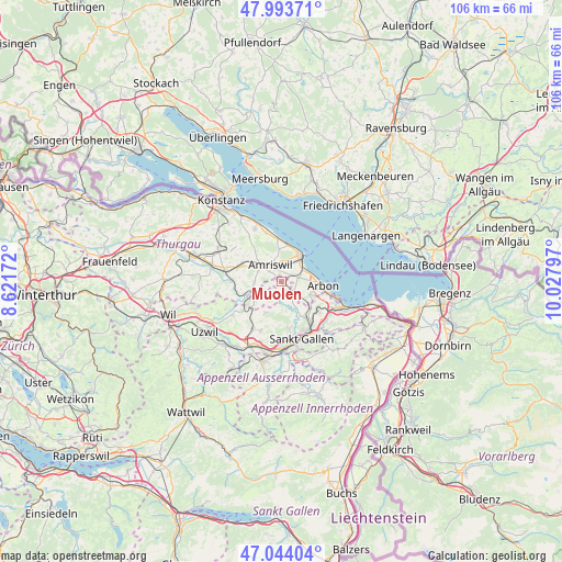
Muolen GPS coordinates[2]
47° 31' 15.672" North, 9° 19' 29.424" East
| Map corner | latitude | longitude |
|---|---|---|
| Upper-left | 47.99371°, | 8.62172° |
| Center: | 47.52102°, | 9.32484° |
| Lower-right: | 47.04404°, | 10.02797° |
| Map W x H: | 105.6×105.6 km | = 65.6×65.6mi |
| max Lat: | 47.76737° ⇑7.7% North |
| Muolen: | 47.52102° |
| min Lat: | ⇓92.3% South 45.83203° |
| min Long | Muolen | max Long |
| 5.97153° | 9.32484° | 10.44624° |
| W 94.4%⇐ | ⇒5.6% E |
Elevation
Elevation of Muolen is 491 m = 1611 ft, and this is 67.2 m = 220 ft below average elevation for this country.
| Max E: |
1845 m = 6053 ft | 46.1% |
| Avg. | 558.2 m = 1831 ft | |
| Muolen | 491 m = 1611 ft | |
Min E: |
197 m = 646 ft | 53.9% |
See also: Switzerland elevation on elevation.city.
Geographical zone
Muolen is located in North temperate zone (between Tropic of Cancer and the Arctic Circle). Distance of this North polar circle is 2117.3 km =1315.6 mi to North.| Distance of | km | miles | from Muolen |
|---|---|---|---|
| North Pole | 4723.2 | 2934.9 | to North |
| Arctic Circle | 2117.3 | 1315.6 | to North |
| Tropic Cancer | 2677.9 | 1664 | to South |
| Equator | 5283.8 | 3283.2 | to South |


Nearby cities:
15 places around Muolen: (largest is in red/bold)
• Amriswil
3.6 km =2.2 mi,  323°
323°
• Arbon
8.2 km =5.1 mi,  93°
93°
• Egnach
4.8 km =3 mi,  60°
60°
• Erlen
7.4 km =4.6 mi,  293°
293°
• Güttingen
9.6 km =6 mi,  342°
342°
• Hohentannen
7.6 km =4.7 mi,  259°
259°
• Häggenschwil
3.3 km =2.1 mi,  152°
152°
• Kesswil
8.1 km =5 mi,  355°
355°
• Mörschwil
9.2 km =5.7 mi,  127°
127°
• Roggwil
5.8 km =3.6 mi,  113°
113°
• Romanshorn
6.4 km =4 mi,  39°
39°
• Salmsach
5.1 km =3.2 mi, 43°
• Uttwil
7.2 km =4.5 mi,  9°
9°
• Waldkirch
6.5 km =4 mi,  206°
206°
• Wittenbach
8.1 km =5 mi, 145°
Sources, notices
• [Note1] Compared only with cities in Switzerland existing in our database
• [Src1] Map data: © OpenStreetMap contributors (CC-BY-SA)
• [Src2] Other city data from geonames.org with taken over terms of usage.
• [Src3] Geographical zone / Annual Mean Temperature by Robert A. Rohde @ Wikipedia
