Vitznau geodata
Vitznau (Lucerne) is a populated place; located in Switzerland in Europe/Zurich (GMT+2) time zone. With population of 1,496 people, there are 1039 cities with bigger population in this country. Compared to other cities in Switzerland, 64% of cities are located further ↑North; 56% of cities are located further ←West and 63.8% of cities have higher elevation than Vitznau. Note1


Vitznau GPS coordinates[2]
47° 0' 36.504" North, 8° 29' 3.12" East
| Map corner | latitude | longitude |
|---|---|---|
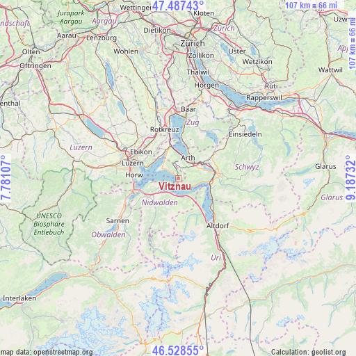
| Upper-left | 47.48743°, | 7.78107° |
| Center: | 47.01014°, | 8.4842° |
| Lower-right: | 46.52855°, | 9.18732° |
| Map W x H: | 106.6×106.6 km | = 66.2×66.2mi |
| max Lat: | 47.76737° ⇑64% North |
| Vitznau: | 47.01014° |
| min Lat: | ⇓36% South 45.83203° |
| min Long | Vitznau | max Long |
| 5.97153° | 8.4842° | 10.44624° |
| W 56%⇐ | ⇒44% E |
Elevation
Elevation of Vitznau is 448 m = 1470 ft, and this is 110.2 m = 362 ft below average elevation for this country.
| Max E: |
1845 m = 6053 ft | 63.8% |
| Avg. | 558.2 m = 1831 ft | |
| Vitznau | 448 m = 1470 ft | |
Min E: |
197 m = 646 ft | 36.2% |
See also: Switzerland elevation on elevation.city.
Geographical zone
Vitznau is located in North temperate zone (between Tropic of Cancer and the Arctic Circle). Distance of this North polar circle is 2174.1 km =1350.9 mi to North.| Distance of | km | miles | from Vitznau |
|---|---|---|---|
| North Pole | 4780 | 2970.2 | to North |
| Arctic Circle | 2174.1 | 1350.9 | to North |
| Tropic Cancer | 2621.1 | 1628.7 | to South |
| Equator | 5227 | 3247.9 | to South |


Nearby cities:
15 places around Vitznau: (largest is in red/bold)
• Arth
6.6 km =4.1 mi,  26°
26°
• Beckenried
4.9 km =3 mi,  187°
187°
• Buochs
6.2 km =3.9 mi,  229°
229°
• Emmetten
6.4 km =4 mi,  158°
158°
• Ennetbürgen
6.3 km =3.9 mi,  242°
242°
• Gersau
3.6 km =2.2 mi,  119°
119°
• Goldau
6.3 km =3.9 mi,  48°
48°
• Greppen
6.4 km =4 mi,  320°
320°
• Ingenbohl
10 km =6.2 mi,  97°
97°
• Küssnacht
9 km =5.6 mi,  339°
339°
• Lauerz
7.9 km =4.9 mi,  71°
71°
• Meggen
9.3 km =5.8 mi,  296°
296°
• Seelisberg
8.8 km =5.5 mi, 117°
• Steinerberg
9.2 km =5.7 mi,  57°
57°
• Weggis
4.6 km =2.9 mi, 301°
Sources, notices
• [Note1] Compared only with cities in Switzerland existing in our database
• [Src1] Map data: © OpenStreetMap contributors (CC-BY-SA)
• [Src2] Other city data from geonames.org with taken over terms of usage.
• [Src3] Geographical zone / Annual Mean Temperature by Robert A. Rohde @ Wikipedia
