Lauerz geodata
Lauerz (Schwyz) is a populated place; located in Switzerland in Europe/Zurich (GMT+2) time zone. With population of 913 people, there are 1399 cities with bigger population in this country. Compared to other cities in Switzerland, 62.7% of cities are located further ↑North; 64.4% of cities are located further ←West and 62.2% of cities have higher elevation than Lauerz. Note1


Lauerz GPS coordinates[2]
47° 1' 59.772" North, 8° 35' 0.204" East
| Map corner | latitude | longitude |
|---|---|---|
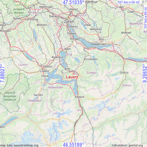
| Upper-left | 47.51035°, | 7.88027° |
| Center: | 47.03327°, | 8.58339° |
| Lower-right: | 46.55189°, | 9.28652° |
| Map W x H: | 106.6×106.6 km | = 66.2×66.2mi |
| max Lat: | 47.76737° ⇑62.7% North |
| Lauerz: | 47.03327° |
| min Lat: | ⇓37.3% South 45.83203° |
| min Long | Lauerz | max Long |
| 5.97153° | 8.58339° | 10.44624° |
| W 64.4%⇐ | ⇒35.6% E |
Elevation
Elevation of Lauerz is 451 m = 1480 ft, and this is 107.2 m = 352 ft below average elevation for this country.
| Max E: |
1845 m = 6053 ft | 62.2% |
| Avg. | 558.2 m = 1831 ft | |
| Lauerz | 451 m = 1480 ft | |
Min E: |
197 m = 646 ft | 37.8% |
See also: Switzerland elevation on elevation.city.
Geographical zone
Lauerz is located in North temperate zone (between Tropic of Cancer and the Arctic Circle). Distance of this North polar circle is 2171.6 km =1349.4 mi to North.| Distance of | km | miles | from Lauerz |
|---|---|---|---|
| North Pole | 4777.5 | 2968.6 | to North |
| Arctic Circle | 2171.6 | 1349.4 | to North |
| Tropic Cancer | 2623.7 | 1630.3 | to South |
| Equator | 5229.6 | 3249.5 | to South |


Nearby cities:
15 places around Lauerz: (largest is in red/bold)
• Arth
5.6 km =3.5 mi,  306°
306°
• Emmetten
10 km =6.2 mi,  211°
211°
• Gersau
6.2 km =3.9 mi,  225°
225°
• Goldau
3.2 km =2 mi,  299°
299°
• Ibach
5.3 km =3.3 mi,  117°
117°
• Ingenbohl
4.5 km =2.8 mi,  147°
147°
• Morschach
6.2 km =3.9 mi, 154°
• Rothenthurm
10.5 km =6.5 mi,  41°
41°
• Sattel
6.8 km =4.2 mi, 35°
• Schwyz
5.5 km =3.4 mi,  104°
104°
• Seelisberg
6.7 km =4.2 mi,  177°
177°
• Steinen
2.8 km =1.7 mi,  49°
49°
• Steinerberg
2.4 km =1.5 mi,  4°
4°
• Vitznau
7.9 km =4.9 mi,  251°
251°
• Walchwil
9.1 km =5.7 mi,  326°
326°
Sources, notices
• [Note1] Compared only with cities in Switzerland existing in our database
• [Src1] Map data: © OpenStreetMap contributors (CC-BY-SA)
• [Src2] Other city data from geonames.org with taken over terms of usage.
• [Src3] Geographical zone / Annual Mean Temperature by Robert A. Rohde @ Wikipedia
