Emmetten geodata
Emmetten (Nidwalden) is a seat of a third-order administrative division; located in Switzerland in Europe/Zurich (GMT+2) time zone. With population of 1,232 people, there are 1175 cities with bigger population in this country. Compared to other cities in Switzerland, 66.5% of cities are located further ↑North; 57.7% of cities are located further ←West and 86.8% of cities have lower elevation than Emmetten. Note1


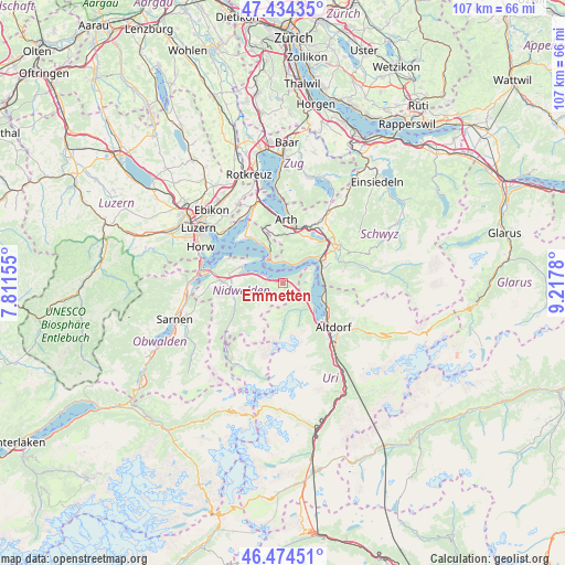
Emmetten GPS coordinates[2]
46° 57' 23.688" North, 8° 30' 52.812" East
| Map corner | latitude | longitude |
|---|---|---|
| Upper-left | 47.43435°, | 7.81155° |
| Center: | 46.95658°, | 8.51467° |
| Lower-right: | 46.47451°, | 9.2178° |
| Map W x H: | 106.7×106.7 km | = 66.3×66.3mi |
| max Lat: | 47.76737° ⇑66.5% North |
| Emmetten: | 46.95658° |
| min Lat: | ⇓33.5% South 45.83203° |
| min Long | Emmetten | max Long |
| 5.97153° | 8.51467° | 10.44624° |
| W 57.7%⇐ | ⇒42.3% E |
Elevation
Elevation of Emmetten is 761 m = 2497 ft, and this is 202.8 m = 665 ft above average elevation for this country.
| Max E: |
1845 m = 6053 ft | 13.2% |
| Emmetten | 761 m 2497 ft | |
| Avg. | 558.2 m = 1831 ft | |
Min E: |
197 m = 646 ft | 86.8% |
See also: Switzerland elevation on elevation.city.
Geographical zone
Emmetten is located in North temperate zone (between Tropic of Cancer and the Arctic Circle). Distance of this North polar circle is 2180.1 km =1354.7 mi to North.| Distance of | km | miles | from Emmetten |
|---|---|---|---|
| North Pole | 4786 | 2973.9 | to North |
| Arctic Circle | 2180.1 | 1354.7 | to North |
| Tropic Cancer | 2615.2 | 1625 | to South |
| Equator | 5221.1 | 3244.2 | to South |


Nearby cities:
15 places around Emmetten: (largest is in red/bold)
• Bauen
5.4 km =3.4 mi,  115°
115°
• Beckenried
3.2 km =2 mi,  290°
290°
• Buochs
7.2 km =4.5 mi, 285°
• Dallenwil
10.3 km =6.4 mi,  249°
249°
• Ennetbürgen
8.5 km =5.3 mi, 291°
• Flüelen
10.1 km =6.3 mi, 124°
• Gersau
4.3 km =2.7 mi,  10°
10°
• Goldau
10.4 km =6.5 mi, 13°
• Ingenbohl
9 km =5.6 mi,  58°
58°
• Isenthal
6.2 km =3.9 mi,  145°
145°
• Lauerz
10 km =6.2 mi,  31°
31°
• Morschach
8.4 km =5.2 mi,  69°
69°
• Seelisberg
5.8 km =3.6 mi, 71°
• Vitznau
6.4 km =4 mi,  338°
338°
• Weggis
10.5 km =6.5 mi,  323°
323°
Sources, notices
• [Note1] Compared only with cities in Switzerland existing in our database
• [Src1] Map data: © OpenStreetMap contributors (CC-BY-SA)
• [Src2] Other city data from geonames.org with taken over terms of usage.
• [Src3] Geographical zone / Annual Mean Temperature by Robert A. Rohde @ Wikipedia
