Ingenbohl geodata
Ingenbohl (Schwyz) is a populated place; located in Switzerland in Europe/Zurich (GMT+2) time zone. With population of 7,967 people, there are 199 cities with bigger population in this country. Compared to other cities in Switzerland, 64.5% of cities are located further ↑North; 67.7% of cities are located further ←West and 70.8% of cities have higher elevation than Ingenbohl. Note1


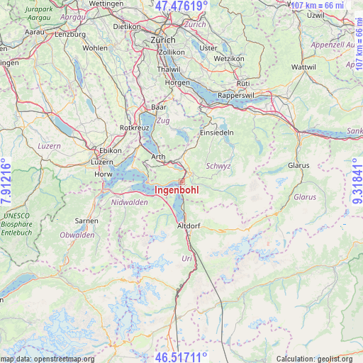
Ingenbohl GPS coordinates[2]
46° 59' 55.68" North, 8° 36' 55.044" East
| Map corner | latitude | longitude |
|---|---|---|
| Upper-left | 47.47619°, | 7.91216° |
| Center: | 46.9988°, | 8.61529° |
| Lower-right: | 46.51711°, | 9.31841° |
| Map W x H: | 106.6×106.6 km | = 66.2×66.2mi |
| max Lat: | 47.76737° ⇑64.5% North |
| Ingenbohl: | 46.9988° |
| min Lat: | ⇓35.5% South 45.83203° |
| min Long | Ingenbohl | max Long |
| 5.97153° | 8.61529° | 10.44624° |
| W 67.7%⇐ | ⇒32.3% E |
Elevation
Elevation of Ingenbohl is 438 m = 1437 ft, and this is 120.2 m = 394 ft below average elevation for this country.
| Max E: |
1845 m = 6053 ft | 70.8% |
| Avg. | 558.2 m = 1831 ft | |
| Ingenbohl | 438 m = 1437 ft | |
Min E: |
197 m = 646 ft | 29.2% |
See also: Switzerland elevation on elevation.city.
Geographical zone
Ingenbohl is located in North temperate zone (between Tropic of Cancer and the Arctic Circle). Distance of this North polar circle is 2175.4 km =1351.7 mi to North.| Distance of | km | miles | from Ingenbohl |
|---|---|---|---|
| North Pole | 4781.3 | 2971 | to North |
| Arctic Circle | 2175.4 | 1351.7 | to North |
| Tropic Cancer | 2619.9 | 1627.9 | to South |
| Equator | 5225.8 | 3247.2 | to South |


Nearby cities:
15 places around Ingenbohl: (largest is in red/bold)
• Arth
10 km =6.2 mi,  315°
315°
• Bauen
7.6 km =4.7 mi,  201°
201°
• Emmetten
9 km =5.6 mi,  238°
238°
• Gersau
6.9 km =4.3 mi,  265°
265°
• Goldau
7.5 km =4.7 mi, 316°
• Ibach
2.7 km =1.7 mi,  59°
59°
• Illgau
8.4 km =5.2 mi,  98°
98°
• Lauerz
4.5 km =2.8 mi,  327°
327°
• Morschach
1.8 km =1.1 mi,  172°
172°
• Sattel
9.4 km =5.8 mi,  9°
9°
• Schwyz
3.8 km =2.4 mi,  50°
50°
• Seelisberg
3.6 km =2.2 mi,  216°
216°
• Steinen
5.7 km =3.5 mi,  357°
357°
• Steinerberg
6.6 km =4.1 mi,  340°
340°
• Vitznau
10 km =6.2 mi,  277°
277°
Sources, notices
• [Note1] Compared only with cities in Switzerland existing in our database
• [Src1] Map data: © OpenStreetMap contributors (CC-BY-SA)
• [Src2] Other city data from geonames.org with taken over terms of usage.
• [Src3] Geographical zone / Annual Mean Temperature by Robert A. Rohde @ Wikipedia
