Arth geodata
Arth (Schwyz) is a seat of a third-order administrative division; located in Switzerland in Europe/Zurich (GMT+2) time zone. With population of 9,850 people, there are 155 cities with bigger population in this country. Compared to other cities in Switzerland, 60.9% of cities are located further ↑North; 58.8% of cities are located further ←West and 78.4% of cities have higher elevation than Arth. Note1


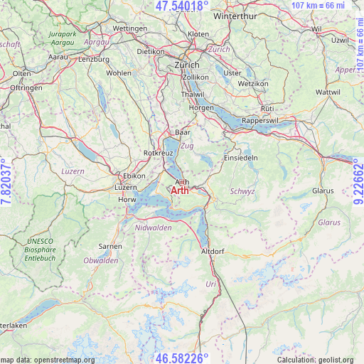
Arth GPS coordinates[2]
47° 3' 48.132" North, 8° 31' 24.564" East
| Map corner | latitude | longitude |
|---|---|---|
| Upper-left | 47.54018°, | 7.82037° |
| Center: | 47.06337°, | 8.52349° |
| Lower-right: | 46.58226°, | 9.22662° |
| Map W x H: | 106.5×106.5 km | = 66.2×66.2mi |
| max Lat: | 47.76737° ⇑60.9% North |
| Arth: | 47.06337° |
| min Lat: | ⇓39.1% South 45.83203° |
| min Long | Arth | max Long |
| 5.97153° | 8.52349° | 10.44624° |
| W 58.8%⇐ | ⇒41.2% E |
Elevation
Elevation of Arth is 425 m = 1394 ft, and this is 133.2 m = 437 ft below average elevation for this country.
| Max E: |
1845 m = 6053 ft | 78.4% |
| Avg. | 558.2 m = 1831 ft | |
| Arth | 425 m = 1394 ft | |
Min E: |
197 m = 646 ft | 21.6% |
See also: Switzerland elevation on elevation.city.
Geographical zone
Arth is located in North temperate zone (between Tropic of Cancer and the Arctic Circle). Distance of this North polar circle is 2168.2 km =1347.3 mi to North.| Distance of | km | miles | from Arth |
|---|---|---|---|
| North Pole | 4774.1 | 2966.5 | to North |
| Arctic Circle | 2168.2 | 1347.3 | to North |
| Tropic Cancer | 2627 | 1632.3 | to South |
| Equator | 5233 | 3251.6 | to South |


Nearby cities:
15 places around Arth: (largest is in red/bold)
• Gersau
7.7 km =4.8 mi,  179°
179°
• Goldau
2.5 km =1.6 mi,  135°
135°
• Greppen
7.2 km =4.5 mi,  261°
261°
• Ingenbohl
10 km =6.2 mi, 135°
• Küssnacht
6.6 km =4.1 mi,  291°
291°
• Lauerz
5.6 km =3.5 mi,  126°
126°
• Meierskappel
9.2 km =5.7 mi,  318°
318°
• Sattel
8.8 km =5.5 mi,  75°
75°
• Steinen
6.9 km =4.3 mi,  102°
102°
• Steinerberg
4.8 km =3 mi, 101°
• Udligenswil
9.6 km =6 mi, 288°
• Unterägeri
9.4 km =5.8 mi,  29°
29°
• Vitznau
6.6 km =4.1 mi,  206°
206°
• Walchwil
4.3 km =2.7 mi,  353°
353°
• Weggis
7.7 km =4.8 mi,  243°
243°
Sources, notices
• [Note1] Compared only with cities in Switzerland existing in our database
• [Src1] Map data: © OpenStreetMap contributors (CC-BY-SA)
• [Src2] Other city data from geonames.org with taken over terms of usage.
• [Src3] Geographical zone / Annual Mean Temperature by Robert A. Rohde @ Wikipedia
