Kölliken geodata
Kölliken (Aargau) is a populated place; located in Switzerland in Europe/Zurich (GMT+2) time zone. With population of 4,059 people, there are 430 cities with bigger population in this country. Compared to other cities in Switzerland, 62.7% of cities are located further ↓South; 59.7% of cities are located further →East and 77.8% of cities have higher elevation than Kölliken. Note1


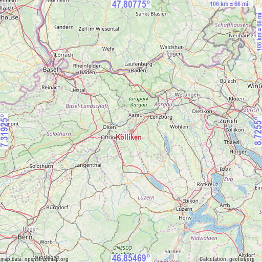
Kölliken GPS coordinates[2]
47° 20' 0.132" North, 8° 1' 20.532" East
| Map corner | latitude | longitude |
|---|---|---|
| Upper-left | 47.80775°, | 7.31925° |
| Center: | 47.33337°, | 8.02237° |
| Lower-right: | 46.85469°, | 8.7255° |
| Map W x H: | 106×106 km | = 65.9×65.9mi |
| max Lat: | 47.76737° ⇑37.3% North |
| Kölliken: | 47.33337° |
| min Lat: | ⇓62.7% South 45.83203° |
| min Long | Kölliken | max Long |
| 5.97153° | 8.02237° | 10.44624° |
| W 40.3%⇐ | ⇒59.7% E |
Elevation
Elevation of Kölliken is 426 m = 1398 ft, and this is 132.2 m = 434 ft below average elevation for this country.
| Max E: |
1845 m = 6053 ft | 77.8% |
| Avg. | 558.2 m = 1831 ft | |
| Kölliken | 426 m = 1398 ft | |
Min E: |
197 m = 646 ft | 22.2% |
See also: Switzerland elevation on elevation.city.
Geographical zone
Kölliken is located in North temperate zone (between Tropic of Cancer and the Arctic Circle). Distance of this North polar circle is 2138.2 km =1328.6 mi to North.| Distance of | km | miles | from Kölliken |
|---|---|---|---|
| North Pole | 4744.1 | 2947.8 | to North |
| Arctic Circle | 2138.2 | 1328.6 | to North |
| Tropic Cancer | 2657.1 | 1651 | to South |
| Equator | 5263 | 3270.3 | to South |


Nearby cities:
15 places around Kölliken: (largest is in red/bold)
• Aarau
6.8 km =4.2 mi,  14°
14°
• Bottenwil
5.5 km =3.4 mi,  192°
192°
• Gränichen
6.7 km =4.2 mi,  64°
64°
• Muhen
2.5 km =1.6 mi,  83°
83°
• Niedergösgen
5 km =3.1 mi,  328°
328°
• Oberentfelden
3.1 km =1.9 mi,  34°
34°
• Obergösgen
6.4 km =4 mi,  303°
303°
• Safenwil
3.3 km =2.1 mi,  246°
246°
• Schlossrued
6.8 km =4.2 mi,  133°
133°
• Schöftland
3.7 km =2.3 mi,  144°
144°
• Schönenwerd
4.3 km =2.7 mi,  338°
338°
• Staffelbach
5.7 km =3.5 mi,  164°
164°
• Suhr
6.1 km =3.8 mi,  45°
45°
• Teufenthal
7.2 km =4.5 mi,  93°
93°
• Uerkheim
3.3 km =2.1 mi,  178°
178°
Sources, notices
• [Note1] Compared only with cities in Switzerland existing in our database
• [Src1] Map data: © OpenStreetMap contributors (CC-BY-SA)
• [Src2] Other city data from geonames.org with taken over terms of usage.
• [Src3] Geographical zone / Annual Mean Temperature by Robert A. Rohde @ Wikipedia
