Savognin geodata
Savognin (Grisons) is a populated place; located in Switzerland in Europe/Zurich (GMT+2) time zone. With population of 961 people, there are 1361 cities with bigger population in this country. Compared to other cities in Switzerland, 82.6% of cities are located further ↑North; 98.3% of cities are located further ←West and 97.3% of cities have lower elevation than Savognin. Note1


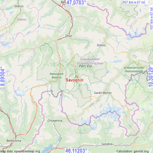
Savognin GPS coordinates[2]
46° 35' 50.352" North, 9° 35' 53.376" East
| Map corner | latitude | longitude |
|---|---|---|
| Upper-left | 47.0783°, | 8.89504° |
| Center: | 46.59732°, | 9.59816° |
| Lower-right: | 46.11203°, | 10.30129° |
| Map W x H: | 107.4×107.4 km | = 66.7×66.7mi |
| max Lat: | 47.76737° ⇑82.6% North |
| Savognin: | 46.59732° |
| min Lat: | ⇓17.4% South 45.83203° |
| min Long | Savognin | max Long |
| 5.97153° | 9.59816° | 10.44624° |
| W 98.3%⇐ | ⇒1.7% E |
Elevation
Elevation of Savognin is 1219 m = 3999 ft, and this is 660.8 m = 2168 ft above average elevation for this country.
| Max E: |
1845 m = 6053 ft | 2.7% |
| Savognin | 1219 m 3999 ft | |
| Avg. | 558.2 m = 1831 ft | |
Min E: |
197 m = 646 ft | 97.3% |
See also: Switzerland elevation on elevation.city.
Geographical zone
Savognin is located in North temperate zone (between Tropic of Cancer and the Arctic Circle). Distance of this North polar circle is 2220 km =1379.4 mi to North.| Distance of | km | miles | from Savognin |
|---|---|---|---|
| North Pole | 4825.9 | 2998.7 | to North |
| Arctic Circle | 2220 | 1379.4 | to North |
| Tropic Cancer | 2575.2 | 1600.2 | to South |
| Equator | 5181.1 | 3219.4 | to South |


Nearby cities:
15 places around Savognin: (largest is in red/bold)
• Andeer
13.2 km =8.2 mi,  272°
272°
• Arosa
20.9 km =13 mi,  16°
16°
• Bergün
12 km =7.5 mi,  72°
72°
• Cazis
18.5 km =11.5 mi,  317°
317°
• Celerina
22 km =13.7 mi,  115°
115°
• Churwalden
20.9 km =13 mi,  348°
348°
• Donat
13.3 km =8.3 mi,  285°
285°
• Filisur
10.8 km =6.7 mi,  38°
38°
• Lenzerheide
14.2 km =8.8 mi, 347°
• Scharans
17.1 km =10.6 mi, 321°
• Sils im Domleschg
15.9 km =9.9 mi, 316°
• Silvaplana
21.6 km =13.4 mi,  135°
135°
• St. Moritz
21.7 km =13.5 mi, 120°
• Thusis
16.4 km =10.2 mi,  312°
312°
• Tiefencastel
7.1 km =4.4 mi, 348°
Sources, notices
• [Note1] Compared only with cities in Switzerland existing in our database
• [Src1] Map data: © OpenStreetMap contributors (CC-BY-SA)
• [Src2] Other city data from geonames.org with taken over terms of usage.
• [Src3] Geographical zone / Annual Mean Temperature by Robert A. Rohde @ Wikipedia
