Silvaplana geodata
Silvaplana (Grisons) is a seat of a third-order administrative division; located in Switzerland in Europe/Zurich (GMT+2) time zone. With population of 973 people, there are 1348 cities with bigger population in this country. Compared to other cities in Switzerland, 87% of cities are located further ↑North; 99.1% of cities are located further ←West and 99.8% of cities have lower elevation than Silvaplana. Note1


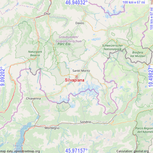
Silvaplana GPS coordinates[2]
46° 27' 29.16" North, 9° 47' 42.504" East
| Map corner | latitude | longitude |
|---|---|---|
| Upper-left | 46.94032°, | 9.09202° |
| Center: | 46.4581°, | 9.79514° |
| Lower-right: | 45.97157°, | 10.49827° |
| Map W x H: | 107.7×107.7 km | = 66.9×66.9mi |
| max Lat: | 47.76737° ⇑87% North |
| Silvaplana: | 46.4581° |
| min Lat: | ⇓13% South 45.83203° |
| min Long | Silvaplana | max Long |
| 5.97153° | 9.79514° | 10.44624° |
| W 99.1%⇐ | ⇒0.90000000000001% E |
Elevation
Elevation of Silvaplana is 1817 m = 5961 ft, and this is 1258.8 m = 4130 ft above average elevation for this country.
| Max E: |
1845 m = 6053 ft | 0.2% |
| Silvaplana | 1817 m 5961 ft | |
| Avg. | 558.2 m = 1831 ft | |
Min E: |
197 m = 646 ft | 99.8% |
See also: Switzerland elevation on elevation.city.
Geographical zone
Silvaplana is located in North temperate zone (between Tropic of Cancer and the Arctic Circle). Distance of this North polar circle is 2235.5 km =1389.1 mi to North.| Distance of | km | miles | from Silvaplana |
|---|---|---|---|
| North Pole | 4841.4 | 3008.3 | to North |
| Arctic Circle | 2235.5 | 1389.1 | to North |
| Tropic Cancer | 2559.7 | 1590.5 | to South |
| Equator | 5165.7 | 3209.8 | to South |


Nearby cities:
15 places around Silvaplana: (largest is in red/bold)
• Bergün
19.4 km =12.1 mi,  349°
349°
• Celerina
7.7 km =4.8 mi,  38°
38°
• Filisur
25.3 km =15.7 mi,  340°
340°
• La Punt Chamues-ch
16.5 km =10.3 mi, 35°
• Pontresina
9.1 km =5.7 mi,  62°
62°
• Poschiavo
25.1 km =15.6 mi,  126°
126°
• Promontogno
22.5 km =14 mi,  234°
234°
• Samedan
10.3 km =6.4 mi, 35°
• Savognin
21.6 km =13.4 mi,  315°
315°
• Scanfs
22.5 km =14 mi, 40°
• Sils-Segl Maria
4 km =2.5 mi,  216°
216°
• St. Moritz
5.9 km =3.7 mi, 38°
• Stampa
20.2 km =12.6 mi, 230°
• Tiefencastel
27.9 km =17.3 mi, 323°
• Zuoz
20.4 km =12.7 mi, 38°
Sources, notices
• [Note1] Compared only with cities in Switzerland existing in our database
• [Src1] Map data: © OpenStreetMap contributors (CC-BY-SA)
• [Src2] Other city data from geonames.org with taken over terms of usage.
• [Src3] Geographical zone / Annual Mean Temperature by Robert A. Rohde @ Wikipedia
