St. Moritz geodata
St. Moritz (Grisons) is a populated place; located in Switzerland in Europe/Zurich (GMT+2) time zone. With population of 4,952 people, there are 348 cities with bigger population in this country. Compared to other cities in Switzerland, 85.7% of cities are located further ↑North; 99.3% of cities are located further ←West and 100% of cities have lower elevation than St. Moritz. Note1


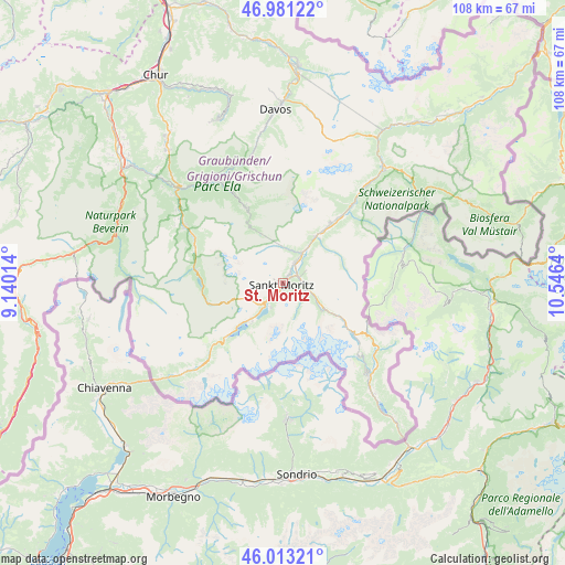
St. Moritz GPS coordinates[2]
46° 29' 57.732" North, 9° 50' 35.772" East
| Map corner | latitude | longitude |
|---|---|---|
| Upper-left | 46.98122°, | 9.14014° |
| Center: | 46.49937°, | 9.84327° |
| Lower-right: | 46.01321°, | 10.5464° |
| Map W x H: | 107.6×107.6 km | = 66.9×66.9mi |
| max Lat: | 47.76737° ⇑85.7% North |
| St. Moritz: | 46.49937° |
| min Lat: | ⇓14.3% South 45.83203° |
| min Long | St. Moritz | max Long |
| 5.97153° | 9.84327° | 10.44624° |
| W 99.3%⇐ | ⇒0.7% E |
Elevation
Elevation of St. Moritz is 1845 m = 6053 ft, and this is 1286.8 m = 4222 ft above average elevation for this country.
| Max E: |
1845 m = 6053 ft | 0% |
| St. Moritz | 1845 m 6053 ft | |
| Avg. | 558.2 m = 1831 ft | |
Min E: |
197 m = 646 ft | 100% |
See also: Switzerland elevation on elevation.city.
Geographical zone
St. Moritz is located in North temperate zone (between Tropic of Cancer and the Arctic Circle). Distance of this North polar circle is 2230.9 km =1386.2 mi to North.| Distance of | km | miles | from St. Moritz |
|---|---|---|---|
| North Pole | 4836.8 | 3005.4 | to North |
| Arctic Circle | 2230.9 | 1386.2 | to North |
| Tropic Cancer | 2564.3 | 1593.4 | to South |
| Equator | 5170.2 | 3212.6 | to South |


Nearby cities:
15 places around St. Moritz: (largest is in red/bold)
• Bergün
16.2 km =10.1 mi,  333°
333°
• Celerina
1.8 km =1.1 mi,  38°
38°
• Filisur
22.7 km =14.1 mi, 328°
• La Punt Chamues-ch
10.6 km =6.6 mi,  33°
33°
• Pontresina
4.5 km =2.8 mi,  95°
95°
• Poschiavo
25.5 km =15.8 mi,  139°
139°
• Promontogno
28.2 km =17.5 mi,  230°
230°
• Samedan
4.5 km =2.8 mi, 30°
• Savognin
21.7 km =13.5 mi,  300°
300°
• Scanfs
16.6 km =10.3 mi, 40°
• Sils-Segl Maria
9.9 km =6.2 mi,  217°
217°
• Silvaplana
5.9 km =3.7 mi, 218°
• Stampa
26 km =16.2 mi, 228°
• Tiefencastel
27 km =16.8 mi,  311°
311°
• Zuoz
14.5 km =9 mi, 37°
In other languages:
- In Spanish: Sankt Moritz
- In France: Saint-Moritz
- In German: Sankt Moritz, St. Moritz
- In Italian: Sankt Moritz
Sources, notices
• [Note1] Compared only with cities in Switzerland existing in our database
• [Src1] Map data: © OpenStreetMap contributors (CC-BY-SA)
• [Src2] Other city data from geonames.org with taken over terms of usage.
• [Src3] Geographical zone / Annual Mean Temperature by Robert A. Rohde @ Wikipedia
