Saland geodata
Saland (Zurich) is a populated place; located in Switzerland in Europe/Zurich (GMT+2) time zone. With population of 526 people, there are 1769 cities with bigger population in this country. Compared to other cities in Switzerland, 71.2% of cities are located further ↓South; 83.1% of cities are located further ←West and 73.9% of cities have lower elevation than Saland. Note1


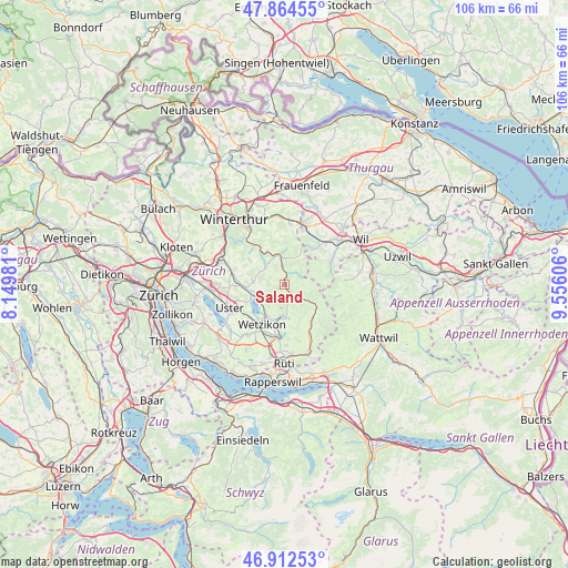
Saland GPS coordinates[2]
47° 23' 26.484" North, 8° 51' 10.584" East
| Map corner | latitude | longitude |
|---|---|---|
| Upper-left | 47.86455°, | 8.14981° |
| Center: | 47.39069°, | 8.85294° |
| Lower-right: | 46.91253°, | 9.55606° |
| Map W x H: | 105.9×105.9 km | = 65.8×65.8mi |
| max Lat: | 47.76737° ⇑28.8% North |
| Saland: | 47.39069° |
| min Lat: | ⇓71.2% South 45.83203° |
| min Long | Saland | max Long |
| 5.97153° | 8.85294° | 10.44624° |
| W 83.1%⇐ | ⇒16.9% E |
Elevation
Elevation of Saland is 606 m = 1988 ft, and this is 47.8 m = 157 ft above average elevation for this country.
| Max E: |
1845 m = 6053 ft | 26.1% |
| Saland | 606 m 1988 ft | |
| Avg. | 558.2 m = 1831 ft | |
Min E: |
197 m = 646 ft | 73.9% |
See also: Switzerland elevation on elevation.city.
Geographical zone
Saland is located in North temperate zone (between Tropic of Cancer and the Arctic Circle). Distance of this North polar circle is 2131.8 km =1324.6 mi to North.| Distance of | km | miles | from Saland |
|---|---|---|---|
| North Pole | 4737.7 | 2943.9 | to North |
| Arctic Circle | 2131.8 | 1324.6 | to North |
| Tropic Cancer | 2663.4 | 1655 | to South |
| Equator | 5269.4 | 3274.3 | to South |


Nearby cities:
15 places around Saland: (largest is in red/bold)
• Adetswil
5.8 km =3.6 mi,  189°
189°
• Altlandenberg
2.4 km =1.5 mi,  151°
151°
• Bauma
3.2 km =2 mi,  142°
142°
• Bäretswil
6 km =3.7 mi,  177°
177°
• Hittnau / Hittnau (Dorf)
3.7 km =2.3 mi,  215°
215°
• Oberhittnau
4.2 km =2.6 mi,  211°
211°
• Pfäffikon
5.4 km =3.4 mi,  237°
237°
• Pfäffikon / Irgenhausen
5.5 km =3.4 mi, 235°
• Pfäffikon / Pfäffikon (Dorfkern)
5.8 km =3.6 mi,  245°
245°
• Russikon
5.9 km =3.7 mi,  276°
276°
• Rämismühle
5.9 km =3.7 mi,  336°
336°
• Turbenthal
5.1 km =3.2 mi,  354°
354°
• Weid (bei Adetswil)
5.6 km =3.5 mi, 182°
• Wetzikon / Kempten
7.2 km =4.5 mi, 206°
• Wila
3.2 km =2 mi, 349°
Sources, notices
• [Note1] Compared only with cities in Switzerland existing in our database
• [Src1] Map data: © OpenStreetMap contributors (CC-BY-SA)
• [Src2] Other city data from geonames.org with taken over terms of usage.
• [Src3] Geographical zone / Annual Mean Temperature by Robert A. Rohde @ Wikipedia
