Wattwil geodata
Wattwil (Saint Gallen) is a populated place; located in Switzerland in Europe/Zurich (GMT+2) time zone. With population of 8,089 people, there are 193 cities with bigger population in this country. Compared to other cities in Switzerland, 57.9% of cities are located further ↓South; 90.6% of cities are located further ←West and 74.7% of cities have lower elevation than Wattwil. Note1


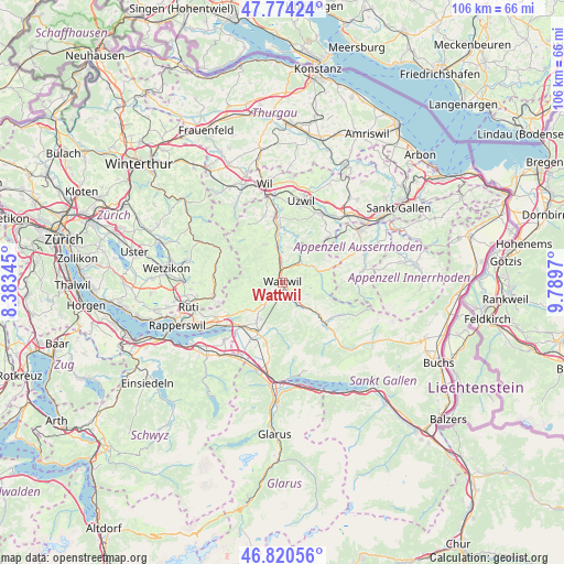
Wattwil GPS coordinates[2]
47° 17' 58.38" North, 9° 5' 11.652" East
| Map corner | latitude | longitude |
|---|---|---|
| Upper-left | 47.77424°, | 8.38345° |
| Center: | 47.29955°, | 9.08657° |
| Lower-right: | 46.82056°, | 9.7897° |
| Map W x H: | 106×106 km | = 65.9×65.9mi |
| max Lat: | 47.76737° ⇑42.1% North |
| Wattwil: | 47.29955° |
| min Lat: | ⇓57.9% South 45.83203° |
| min Long | Wattwil | max Long |
| 5.97153° | 9.08657° | 10.44624° |
| W 90.6%⇐ | ⇒9.4% E |
Elevation
Elevation of Wattwil is 613 m = 2011 ft, and this is 54.8 m = 180 ft above average elevation for this country.
| Max E: |
1845 m = 6053 ft | 25.3% |
| Wattwil | 613 m 2011 ft | |
| Avg. | 558.2 m = 1831 ft | |
Min E: |
197 m = 646 ft | 74.7% |
See also: Switzerland elevation on elevation.city.
Geographical zone
Wattwil is located in North temperate zone (between Tropic of Cancer and the Arctic Circle). Distance of this North polar circle is 2142 km =1331 mi to North.| Distance of | km | miles | from Wattwil |
|---|---|---|---|
| North Pole | 4747.8 | 2950.1 | to North |
| Arctic Circle | 2142 | 1331 | to North |
| Tropic Cancer | 2653.3 | 1648.7 | to South |
| Equator | 5259.2 | 3267.9 | to South |


Nearby cities:
15 places around Wattwil: (largest is in red/bold)
• Brunnadern
5.2 km =3.2 mi,  39°
39°
• Bütschwil
6.8 km =4.2 mi,  350°
350°
• Ebnat-Kappel
5.1 km =3.2 mi,  145°
145°
• Ganterschwil
9.1 km =5.7 mi,  2°
2°
• Goldingen
10.2 km =6.3 mi,  247°
247°
• Gommiswald
9 km =5.6 mi,  212°
212°
• Hemberg
6.7 km =4.2 mi,  88°
88°
• Kaltbrunn
10.6 km =6.6 mi, 205°
• Krummenau
8.6 km =5.3 mi,  132°
132°
• Lichtensteig
2.7 km =1.7 mi, 1°
• Lütisburg
10.6 km =6.6 mi,  358°
358°
• Mogelsberg
7.9 km =4.9 mi,  27°
27°
• Mosnang
7.7 km =4.8 mi,  334°
334°
• Oberhelfenschwil
6.6 km =4.1 mi,  15°
15°
• Sankt Peterzell
7 km =4.3 mi,  73°
73°
Sources, notices
• [Note1] Compared only with cities in Switzerland existing in our database
• [Src1] Map data: © OpenStreetMap contributors (CC-BY-SA)
• [Src2] Other city data from geonames.org with taken over terms of usage.
• [Src3] Geographical zone / Annual Mean Temperature by Robert A. Rohde @ Wikipedia
