Bettingen geodata
Bettingen (Basel-City) is a populated place; located in Switzerland in Europe/Zurich (GMT+2) time zone. With population of 1,189 people, there are 1206 cities with bigger population in this country. Compared to other cities in Switzerland, 95.9% of cities are located further ↓South; 69.3% of cities are located further →East and 92.6% of cities have higher elevation than Bettingen. Note1


Bettingen GPS coordinates[2]
47° 34' 13.404" North, 7° 39' 51.3" East
| Map corner | latitude | longitude |
|---|---|---|
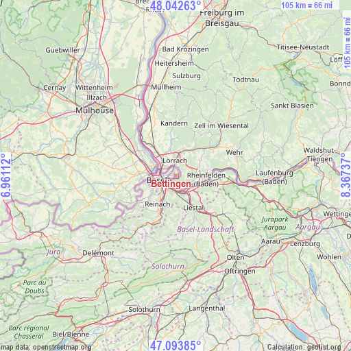
| Upper-left | 48.04263°, | 6.96112° |
| Center: | 47.57039°, | 7.66425° |
| Lower-right: | 47.09385°, | 8.36737° |
| Map W x H: | 105.5×105.5 km | = 65.6×65.6mi |
| max Lat: | 47.76737° ⇑4.1% North |
| Bettingen: | 47.57039° |
| min Lat: | ⇓95.9% South 45.83203° |
| min Long | Bettingen | max Long |
| 5.97153° | 7.66425° | 10.44624° |
| W 30.7%⇐ | ⇒69.3% E |
Elevation
Elevation of Bettingen is 383 m = 1257 ft, and this is 175.2 m = 575 ft below average elevation for this country.
| Max E: |
1845 m = 6053 ft | 92.6% |
| Avg. | 558.2 m = 1831 ft | |
| Bettingen | 383 m = 1257 ft | |
Min E: |
197 m = 646 ft | 7.4% |
See also: Switzerland elevation on elevation.city.
Geographical zone
Bettingen is located in North temperate zone (between Tropic of Cancer and the Arctic Circle). Distance of this North polar circle is 2111.8 km =1312.2 mi to North.| Distance of | km | miles | from Bettingen |
|---|---|---|---|
| North Pole | 4717.7 | 2931.4 | to North |
| Arctic Circle | 2111.8 | 1312.2 | to North |
| Tropic Cancer | 2683.4 | 1667.4 | to South |
| Equator | 5289.3 | 3286.6 | to South |


Nearby cities:
15 places around Bettingen: (largest is in red/bold)
• Arisdorf
9.9 km =6.2 mi,  130°
130°
• Arlesheim
9.1 km =5.7 mi,  201°
201°
• Augst
5.4 km =3.4 mi,  135°
135°
• Basel
7 km =4.3 mi,  258°
258°
• Binningen
7.9 km =4.9 mi,  244°
244°
• Birsfelden
3.6 km =2.2 mi, 237°
• Bottmingen
8.7 km =5.4 mi,  232°
232°
• Frenkendorf
8.1 km =5 mi,  150°
150°
• Füllinsdorf
8.7 km =5.4 mi, 144°
• Kaiseraugst
5.8 km =3.6 mi, 126°
• Muttenz
5.5 km =3.4 mi, 195°
• Münchenstein
7.1 km =4.4 mi,  215°
215°
• Pratteln
5.9 km =3.7 mi,  158°
158°
• Rheinfelden
9.9 km =6.2 mi,  100°
100°
• Riehen
1.6 km =1 mi,  305°
305°
Sources, notices
• [Note1] Compared only with cities in Switzerland existing in our database
• [Src1] Map data: © OpenStreetMap contributors (CC-BY-SA)
• [Src2] Other city data from geonames.org with taken over terms of usage.
• [Src3] Geographical zone / Annual Mean Temperature by Robert A. Rohde @ Wikipedia
