Frauenfeld geodata
Frauenfeld (Thurgau) is a seat of a first-order administrative division; located in Switzerland in Europe/Zurich (GMT+2) time zone. With population of 21,979 people, there are 37 cities with bigger population in this country. Compared to other cities in Switzerland, 95.3% of cities are located further ↓South; 84.6% of cities are located further ←West and 81.7% of cities have higher elevation than Frauenfeld. Note1


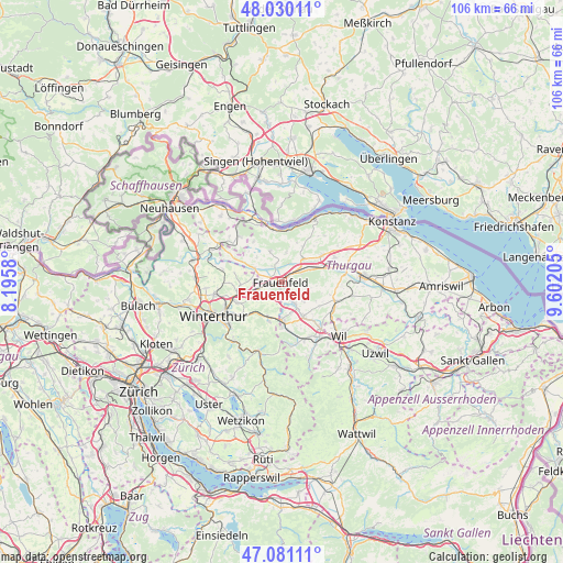
Frauenfeld GPS coordinates[2]
47° 33' 27.936" North, 8° 53' 56.148" East
| Map corner | latitude | longitude |
|---|---|---|
| Upper-left | 48.03011°, | 8.1958° |
| Center: | 47.55776°, | 8.89893° |
| Lower-right: | 47.08111°, | 9.60205° |
| Map W x H: | 105.5×105.5 km | = 65.6×65.6mi |
| max Lat: | 47.76737° ⇑4.7% North |
| Frauenfeld: | 47.55776° |
| min Lat: | ⇓95.3% South 45.83203° |
| min Long | Frauenfeld | max Long |
| 5.97153° | 8.89893° | 10.44624° |
| W 84.6%⇐ | ⇒15.4% E |
Elevation
Elevation of Frauenfeld is 418 m = 1371 ft, and this is 140.2 m = 460 ft below average elevation for this country.
| Max E: |
1845 m = 6053 ft | 81.7% |
| Avg. | 558.2 m = 1831 ft | |
| Frauenfeld | 418 m = 1371 ft | |
Min E: |
197 m = 646 ft | 18.3% |
See also: Switzerland elevation on elevation.city.
Geographical zone
Frauenfeld is located in North temperate zone (between Tropic of Cancer and the Arctic Circle). Distance of this North polar circle is 2113.2 km =1313.1 mi to North.| Distance of | km | miles | from Frauenfeld |
|---|---|---|---|
| North Pole | 4719.1 | 2932.3 | to North |
| Arctic Circle | 2113.2 | 1313.1 | to North |
| Tropic Cancer | 2682 | 1666.5 | to South |
| Equator | 5287.9 | 3285.7 | to South |


Nearby cities:
15 places around Frauenfeld: (largest is in red/bold)
• Aadorf
7.3 km =4.5 mi,  178°
178°
• Elgg
7.2 km =4.5 mi,  200°
200°
• Elgg / Neu-Elgg
6.8 km =4.2 mi, 203°
• Elgg / Städtchen und Umgebung
7.6 km =4.7 mi, 198°
• Gachnang
4 km =2.5 mi,  239°
239°
• Hagenbuch
4.2 km =2.6 mi,  189°
189°
• Herdern
5.1 km =3.2 mi,  10°
10°
• Hüttlingen
6.5 km =4 mi,  69°
69°
• Hüttwilen
5.8 km =3.6 mi,  340°
340°
• Matzingen
5 km =3.1 mi,  148°
148°
• Pfyn
6 km =3.7 mi,  43°
43°
• Rickenbach
7.7 km =4.8 mi,  265°
265°
• Stettfurt
5.4 km =3.4 mi,  131°
131°
• Thundorf
5 km =3.1 mi,  105°
105°
• Wängi
7.9 km =4.9 mi, 149°
Sources, notices
• [Note1] Compared only with cities in Switzerland existing in our database
• [Src1] Map data: © OpenStreetMap contributors (CC-BY-SA)
• [Src2] Other city data from geonames.org with taken over terms of usage.
• [Src3] Geographical zone / Annual Mean Temperature by Robert A. Rohde @ Wikipedia
