Maisprach geodata
Maisprach (Basel-Landschaft) is a populated place; located in Switzerland in Europe/Zurich (GMT+2) time zone. With population of 933 people, there are 1384 cities with bigger population in this country. Compared to other cities in Switzerland, 92.6% of cities are located further ↓South; 64.2% of cities are located further →East and 93.2% of cities have higher elevation than Maisprach. Note1


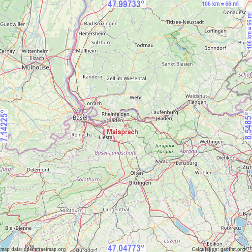
Maisprach GPS coordinates[2]
47° 31' 28.848" North, 7° 50' 43.332" East
| Map corner | latitude | longitude |
|---|---|---|
| Upper-left | 47.99733°, | 7.14225° |
| Center: | 47.52468°, | 7.84537° |
| Lower-right: | 47.04773°, | 8.5485° |
| Map W x H: | 105.6×105.6 km | = 65.6×65.6mi |
| max Lat: | 47.76737° ⇑7.4% North |
| Maisprach: | 47.52468° |
| min Lat: | ⇓92.6% South 45.83203° |
| min Long | Maisprach | max Long |
| 5.97153° | 7.84537° | 10.44624° |
| W 35.8%⇐ | ⇒64.2% E |
Elevation
Elevation of Maisprach is 377 m = 1237 ft, and this is 181.2 m = 594 ft below average elevation for this country.
| Max E: |
1845 m = 6053 ft | 93.2% |
| Avg. | 558.2 m = 1831 ft | |
| Maisprach | 377 m = 1237 ft | |
Min E: |
197 m = 646 ft | 6.8% |
See also: Switzerland elevation on elevation.city.
Geographical zone
Maisprach is located in North temperate zone (between Tropic of Cancer and the Arctic Circle). Distance of this North polar circle is 2116.9 km =1315.4 mi to North.| Distance of | km | miles | from Maisprach |
|---|---|---|---|
| North Pole | 4722.8 | 2934.6 | to North |
| Arctic Circle | 2116.9 | 1315.4 | to North |
| Tropic Cancer | 2678.3 | 1664.2 | to South |
| Equator | 5284.2 | 3283.4 | to South |


Nearby cities:
15 places around Maisprach: (largest is in red/bold)
• Arisdorf
6.2 km =3.9 mi,  258°
258°
• Buus
2.5 km =1.6 mi,  145°
145°
• Gelterkinden
6.7 km =4.2 mi,  175°
175°
• Itingen
7.9 km =4.9 mi,  215°
215°
• Lausen
8.7 km =5.4 mi,  227°
227°
• Magden
2.6 km =1.6 mi,  279°
279°
• Mumpf
6.2 km =3.9 mi,  67°
67°
• Möhlin
3.8 km =2.4 mi,  357°
357°
• Ormalingen
6.5 km =4 mi,  161°
161°
• Rheinfelden
5.1 km =3.2 mi,  310°
310°
• Sissach
7.3 km =4.5 mi,  202°
202°
• Stein
8.3 km =5.2 mi,  75°
75°
• Wegenstetten
7.1 km =4.4 mi,  114°
114°
• Zunzgen
8.8 km =5.5 mi, 198°
• Zuzgen
4.1 km =2.5 mi,  89°
89°
Sources, notices
• [Note1] Compared only with cities in Switzerland existing in our database
• [Src1] Map data: © OpenStreetMap contributors (CC-BY-SA)
• [Src2] Other city data from geonames.org with taken over terms of usage.
• [Src3] Geographical zone / Annual Mean Temperature by Robert A. Rohde @ Wikipedia
