Arisdorf geodata
Arisdorf (Basel-Landschaft) is a populated place; located in Switzerland in Europe/Zurich (GMT+2) time zone. With population of 1,538 people, there are 1013 cities with bigger population in this country. Compared to other cities in Switzerland, 91.1% of cities are located further ↓South; 66.8% of cities are located further →East and 95.2% of cities have higher elevation than Arisdorf. Note1


Arisdorf GPS coordinates[2]
47° 30' 47.628" North, 7° 45' 54.54" East
| Map corner | latitude | longitude |
|---|---|---|
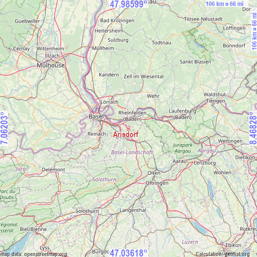
| Upper-left | 47.98599°, | 7.06203° |
| Center: | 47.51323°, | 7.76515° |
| Lower-right: | 47.03618°, | 8.46828° |
| Map W x H: | 105.6×105.6 km | = 65.6×65.6mi |
| max Lat: | 47.76737° ⇑8.9% North |
| Arisdorf: | 47.51323° |
| min Lat: | ⇓91.1% South 45.83203° |
| min Long | Arisdorf | max Long |
| 5.97153° | 7.76515° | 10.44624° |
| W 33.2%⇐ | ⇒66.8% E |
Elevation
Elevation of Arisdorf is 349 m = 1145 ft, and this is 209.2 m = 686 ft below average elevation for this country.
| Max E: |
1845 m = 6053 ft | 95.2% |
| Avg. | 558.2 m = 1831 ft | |
| Arisdorf | 349 m = 1145 ft | |
Min E: |
197 m = 646 ft | 4.8% |
See also: Switzerland elevation on elevation.city.
Geographical zone
Arisdorf is located in North temperate zone (between Tropic of Cancer and the Arctic Circle). Distance of this North polar circle is 2118.2 km =1316.2 mi to North.| Distance of | km | miles | from Arisdorf |
|---|---|---|---|
| North Pole | 4724.1 | 2935.4 | to North |
| Arctic Circle | 2118.2 | 1316.2 | to North |
| Tropic Cancer | 2677.1 | 1663.5 | to South |
| Equator | 5283 | 3282.7 | to South |


Nearby cities:
15 places around Arisdorf: (largest is in red/bold)
• Augst
4.5 km =2.8 mi,  303°
303°
• Buus
7.5 km =4.7 mi,  95°
95°
• Frenkendorf
3.7 km =2.3 mi,  259°
259°
• Füllinsdorf
2.6 km =1.6 mi,  254°
254°
• Itingen
5.4 km =3.4 mi,  163°
163°
• Kaiseraugst
4.2 km =2.6 mi,  315°
315°
• Lausen
4.7 km =2.9 mi,  184°
184°
• Liestal
3.9 km =2.4 mi,  215°
215°
• Magden
3.9 km =2.4 mi,  63°
63°
• Maisprach
6.2 km =3.9 mi,  78°
78°
• Möhlin
7.8 km =4.8 mi,  48°
48°
• Pratteln
5.4 km =3.4 mi,  278°
278°
• Rheinfelden
5.1 km =3.2 mi,  25°
25°
• Seltisberg
6.6 km =4.1 mi,  210°
210°
• Sissach
6.4 km =4 mi,  148°
148°
Sources, notices
• [Note1] Compared only with cities in Switzerland existing in our database
• [Src1] Map data: © OpenStreetMap contributors (CC-BY-SA)
• [Src2] Other city data from geonames.org with taken over terms of usage.
• [Src3] Geographical zone / Annual Mean Temperature by Robert A. Rohde @ Wikipedia
