La Côte-aux-Fées geodata
La Côte-aux-Fées (Neuchâtel) is a populated place; located in Switzerland in Europe/Zurich (GMT+2) time zone. With population of 511 people, there are 1790 cities with bigger population in this country. Compared to other cities in Switzerland, 71.2% of cities are located further ↑North; 95.5% of cities are located further →East and 95.7% of cities have lower elevation than La Côte-aux-Fées. Note1
Administrative division(s):
- Level 1: Neuchâtel
- Level 2: Val-de-Travers District
- Level 3: La Côte-aux-Fées


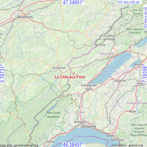
La Côte-aux-Fées GPS coordinates[2]
46° 52' 2.784" North, 6° 29' 25.548" East
| Map corner | latitude | longitude |
|---|---|---|
| Upper-left | 47.34601°, | 5.78731° |
| Center: | 46.86744°, | 6.49043° |
| Lower-right: | 46.38457°, | 7.19356° |
| Map W x H: | 106.9×106.9 km | = 66.4×66.4mi |
| max Lat: | 47.76737° ⇑71.2% North |
| La Côte-aux-Fées: | 46.86744° |
| min Lat: | ⇓28.8% South 45.83203° |
| min Long | La Côte-aux-F� | max Long |
| 5.97153° | 6.49043° | 10.44624° |
| W 4.5%⇐ | ⇒95.5% E |
Elevation
Elevation of La Côte-aux-Fées is 1037 m = 3402 ft, and this is 478.8 m = 1571 ft above average elevation for this country.
| Max E: |
1845 m = 6053 ft | 4.3% |
| La Côte-aux-Fées | 1037 m 3402 ft | |
| Avg. | 558.2 m = 1831 ft | |
Min E: |
197 m = 646 ft | 95.7% |
See also: Switzerland elevation on elevation.city.
Geographical zone
La Côte-aux-Fées is located in North temperate zone (between Tropic of Cancer and the Arctic Circle). Distance of this North polar circle is 2190 km =1360.8 mi to North.| Distance of | km | miles | from La Côte-aux-Fées |
|---|---|---|---|
| North Pole | 4795.9 | 2980 | to North |
| Arctic Circle | 2190 | 1360.8 | to North |
| Tropic Cancer | 2605.3 | 1618.9 | to South |
| Equator | 5211.2 | 3238.1 | to South |


Nearby cities:
15 places around La Côte-aux-Fées: (largest is in red/bold)
• Baulmes
8.9 km =5.5 mi,  163°
163°
• Bullet
6.3 km =3.9 mi,  129°
129°
• Buttes
5.2 km =3.2 mi,  63°
63°
• Champagne
13.5 km =8.4 mi,  106°
106°
• Couvet
12.6 km =7.8 mi, 59°
• Fleurier
8 km =5 mi, 61°
• Grandson
13.5 km =8.4 mi,  118°
118°
• Les Verrières
4.2 km =2.6 mi,  349°
349°
• Montagny
12.4 km =7.7 mi, 131°
• Môtiers
10.4 km =6.5 mi, 62°
• Saint-Sulpice
7.3 km =4.5 mi,  48°
48°
• Sainte-Croix
5.1 km =3.2 mi,  169°
169°
• Valeyres-sous-Montagny
11.9 km =7.4 mi, 129°
• Villars-Burquin
10.6 km =6.6 mi,  101°
101°
• Yverdon-les-Bains
15.1 km =9.4 mi, 130°
Sources, notices
• [Note1] Compared only with cities in Switzerland existing in our database
• [Src1] Map data: © OpenStreetMap contributors (CC-BY-SA)
• [Src2] Other city data from geonames.org with taken over terms of usage.
• [Src3] Geographical zone / Annual Mean Temperature by Robert A. Rohde @ Wikipedia
