Buttes geodata
Buttes (Neuchâtel) is a populated place; located in Switzerland in Europe/Zurich (GMT+2) time zone. With population of 629 people, there are 1664 cities with bigger population in this country. Compared to other cities in Switzerland, 70.3% of cities are located further ↑North; 94.8% of cities are located further →East and 87.6% of cities have lower elevation than Buttes. Note1
Administrative division(s):
- Level 1: Neuchâtel
- Level 2: Val-de-Travers District
- Level 3: Val-de-Travers


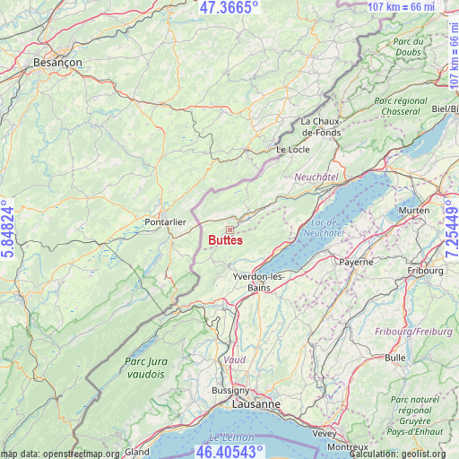
Buttes GPS coordinates[2]
46° 53' 17.232" North, 6° 33' 4.932" East
| Map corner | latitude | longitude |
|---|---|---|
| Upper-left | 47.3665°, | 5.84824° |
| Center: | 46.88812°, | 6.55137° |
| Lower-right: | 46.40543°, | 7.25449° |
| Map W x H: | 106.9×106.9 km | = 66.4×66.4mi |
| max Lat: | 47.76737° ⇑70.3% North |
| Buttes: | 46.88812° |
| min Lat: | ⇓29.7% South 45.83203° |
| min Long | Buttes | max Long |
| 5.97153° | 6.55137° | 10.44624° |
| W 5.2%⇐ | ⇒94.8% E |
Elevation
Elevation of Buttes is 772 m = 2533 ft, and this is 213.8 m = 701 ft above average elevation for this country.
| Max E: |
1845 m = 6053 ft | 12.4% |
| Buttes | 772 m 2533 ft | |
| Avg. | 558.2 m = 1831 ft | |
Min E: |
197 m = 646 ft | 87.6% |
See also: Switzerland elevation on elevation.city.
Geographical zone
Buttes is located in North temperate zone (between Tropic of Cancer and the Arctic Circle). Distance of this North polar circle is 2187.7 km =1359.4 mi to North.| Distance of | km | miles | from Buttes |
|---|---|---|---|
| North Pole | 4793.6 | 2978.6 | to North |
| Arctic Circle | 2187.7 | 1359.4 | to North |
| Tropic Cancer | 2607.6 | 1620.3 | to South |
| Equator | 5213.5 | 3239.5 | to South |


Nearby cities:
15 places around Buttes: (largest is in red/bold)
• Baulmes
11.1 km =6.9 mi,  191°
191°
• Bullet
6.3 km =3.9 mi,  178°
178°
• Champagne
10.3 km =6.4 mi,  127°
127°
• Couvet
7.4 km =4.6 mi,  56°
56°
• Fleurier
2.8 km =1.7 mi, 56°
• Grandson
11.3 km =7 mi,  140°
140°
• La Brévine
11.1 km =6.9 mi,  22°
22°
• La Côte-aux-Fées
5.2 km =3.2 mi,  243°
243°
• Les Verrières
5.7 km =3.5 mi,  288°
288°
• Môtiers
5.2 km =3.2 mi, 60°
• Saint-Sulpice
2.7 km =1.7 mi, 17°
• Sainte-Croix
8.2 km =5.1 mi,  206°
206°
• Travers
11.1 km =6.9 mi, 58°
• Valeyres-sous-Montagny
10.9 km =6.8 mi,  155°
155°
• Villars-Burquin
7.3 km =4.5 mi, 127°
Sources, notices
• [Note1] Compared only with cities in Switzerland existing in our database
• [Src1] Map data: © OpenStreetMap contributors (CC-BY-SA)
• [Src2] Other city data from geonames.org with taken over terms of usage.
• [Src3] Geographical zone / Annual Mean Temperature by Robert A. Rohde @ Wikipedia
