Les Verrières geodata
Les Verrières (Neuchâtel) is a populated place; located in Switzerland in Europe/Zurich (GMT+2) time zone. With population of 736 people, there are 1552 cities with bigger population in this country. Compared to other cities in Switzerland, 69.3% of cities are located further ↑North; 95.6% of cities are located further →East and 93.3% of cities have lower elevation than Les Verrières. Note1
Administrative division(s):
- Level 1: Neuchâtel
- Level 2: Val-de-Travers District
- Level 3: Les Verrières


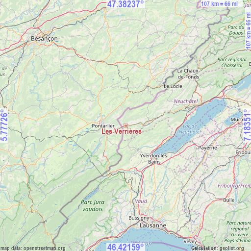
Les Verrières GPS coordinates[2]
46° 54' 14.868" North, 6° 28' 49.404" East
| Map corner | latitude | longitude |
|---|---|---|
| Upper-left | 47.38237°, | 5.77726° |
| Center: | 46.90413°, | 6.48039° |
| Lower-right: | 46.42159°, | 7.18351° |
| Map W x H: | 106.8×106.8 km | = 66.4×66.4mi |
| max Lat: | 47.76737° ⇑69.3% North |
| Les Verrières: | 46.90413° |
| min Lat: | ⇓30.7% South 45.83203° |
| min Long | Les Verrières | max Long |
| 5.97153° | 6.48039° | 10.44624° |
| W 4.4%⇐ | ⇒95.6% E |
Elevation
Elevation of Les Verrières is 932 m = 3058 ft, and this is 373.8 m = 1226 ft above average elevation for this country.
| Max E: |
1845 m = 6053 ft | 6.7% |
| Les Verrières | 932 m 3058 ft | |
| Avg. | 558.2 m = 1831 ft | |
Min E: |
197 m = 646 ft | 93.3% |
See also: Switzerland elevation on elevation.city.
Geographical zone
Les Verrières is located in North temperate zone (between Tropic of Cancer and the Arctic Circle). Distance of this North polar circle is 2185.9 km =1358.3 mi to North.| Distance of | km | miles | from Les Verrières |
|---|---|---|---|
| North Pole | 4791.8 | 2977.5 | to North |
| Arctic Circle | 2185.9 | 1358.3 | to North |
| Tropic Cancer | 2609.3 | 1621.3 | to South |
| Equator | 5215.3 | 3240.6 | to South |


Nearby cities:
15 places around Les Verrières: (largest is in red/bold)
• Baulmes
13.1 km =8.1 mi,  165°
165°
• Bullet
9.9 km =6.2 mi,  145°
145°
• Buttes
5.7 km =3.5 mi,  108°
108°
• Champagne
15.8 km =9.8 mi,  120°
120°
• Couvet
11.8 km =7.3 mi,  78°
78°
• Fleurier
7.8 km =4.8 mi,  91°
91°
• La Brévine
12.8 km =8 mi,  48°
48°
• La Côte-aux-Fées
4.2 km =2.6 mi, 169°
• Montagny
15.9 km =9.9 mi,  140°
140°
• Môtiers
10 km =6.2 mi, 85°
• Saint-Sulpice
6.3 km =3.9 mi, 82°
• Sainte-Croix
9.3 km =5.8 mi, 169°
• Travers
15.4 km =9.6 mi,  74°
74°
• Valeyres-sous-Montagny
15.4 km =9.6 mi, 139°
• Villars-Burquin
12.8 km =8 mi, 118°
Sources, notices
• [Note1] Compared only with cities in Switzerland existing in our database
• [Src1] Map data: © OpenStreetMap contributors (CC-BY-SA)
• [Src2] Other city data from geonames.org with taken over terms of usage.
• [Src3] Geographical zone / Annual Mean Temperature by Robert A. Rohde @ Wikipedia
