Künten geodata
Künten (Aargau) is a populated place; located in Switzerland in Europe/Zurich (GMT+2) time zone. With population of 1,732 people, there are 932 cities with bigger population in this country. Compared to other cities in Switzerland, 70.9% of cities are located further ↓South; 52.4% of cities are located further →East and 77.1% of cities have higher elevation than Künten. Note1


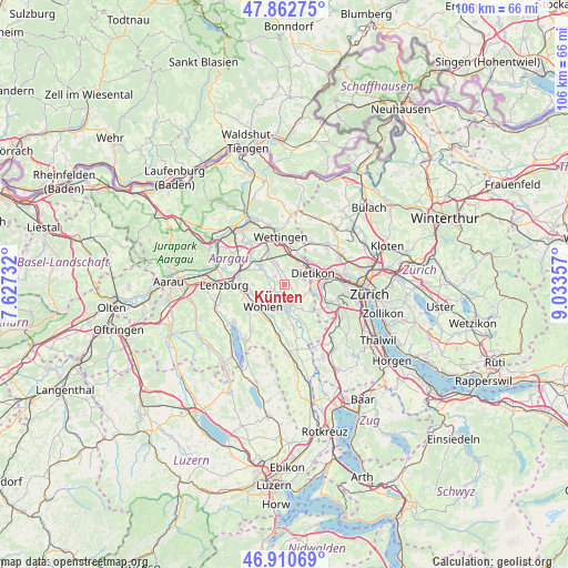
Künten GPS coordinates[2]
47° 23' 19.932" North, 8° 19' 49.62" East
| Map corner | latitude | longitude |
|---|---|---|
| Upper-left | 47.86275°, | 7.62732° |
| Center: | 47.38887°, | 8.33045° |
| Lower-right: | 46.91069°, | 9.03357° |
| Map W x H: | 105.9×105.9 km | = 65.8×65.8mi |
| max Lat: | 47.76737° ⇑29.1% North |
| Künten: | 47.38887° |
| min Lat: | ⇓70.9% South 45.83203° |
| min Long | Künten | max Long |
| 5.97153° | 8.33045° | 10.44624° |
| W 47.6%⇐ | ⇒52.4% E |
Elevation
Elevation of Künten is 427 m = 1401 ft, and this is 131.2 m = 430 ft below average elevation for this country.
| Max E: |
1845 m = 6053 ft | 77.1% |
| Avg. | 558.2 m = 1831 ft | |
| Künten | 427 m = 1401 ft | |
Min E: |
197 m = 646 ft | 22.9% |
See also: Switzerland elevation on elevation.city.
Geographical zone
Künten is located in North temperate zone (between Tropic of Cancer and the Arctic Circle). Distance of this North polar circle is 2132 km =1324.8 mi to North.| Distance of | km | miles | from Künten |
|---|---|---|---|
| North Pole | 4737.9 | 2944 | to North |
| Arctic Circle | 2132 | 1324.8 | to North |
| Tropic Cancer | 2663.2 | 1654.8 | to South |
| Equator | 5269.1 | 3274.1 | to South |


Nearby cities:
15 places around Künten: (largest is in red/bold)
• Berikon
5.2 km =3.2 mi,  142°
142°
• Bremgarten
4.3 km =2.7 mi,  168°
168°
• Dietikon
5.4 km =3.4 mi,  74°
74°
• Dietikon / Almend
4.9 km =3 mi, 69°
• Dietikon / Fondli
4.8 km =3 mi,  63°
63°
• Dietikon / Kreuzacker
5.5 km =3.4 mi,  77°
77°
• Dietikon / Oberdorf
5 km =3.1 mi, 74°
• Dietikon / Rütematt
5.3 km =3.3 mi, 84°
• Dietikon / Vorstadt
5.5 km =3.4 mi, 66°
• Killwangen
5.1 km =3.2 mi,  17°
17°
• Mellingen
5.5 km =3.4 mi,  307°
307°
• Niederrohrdorf
4.4 km =2.7 mi,  333°
333°
• Oberrohrdorf
3.4 km =2.1 mi,  346°
346°
• Rudolfstetten
4.3 km =2.7 mi,  117°
117°
• Spreitenbach
4.7 km =2.9 mi,  36°
36°
Sources, notices
• [Note1] Compared only with cities in Switzerland existing in our database
• [Src1] Map data: © OpenStreetMap contributors (CC-BY-SA)
• [Src2] Other city data from geonames.org with taken over terms of usage.
• [Src3] Geographical zone / Annual Mean Temperature by Robert A. Rohde @ Wikipedia
