Bremgarten geodata
Bremgarten (Aargau) is a seat of a second-order administrative division; located in Switzerland in Europe/Zurich (GMT+2) time zone. With population of 6,543 people, there are 253 cities with bigger population in this country. Compared to other cities in Switzerland, 64.9% of cities are located further ↓South; 52.2% of cities are located further →East and 91.1% of cities have higher elevation than Bremgarten. Note1


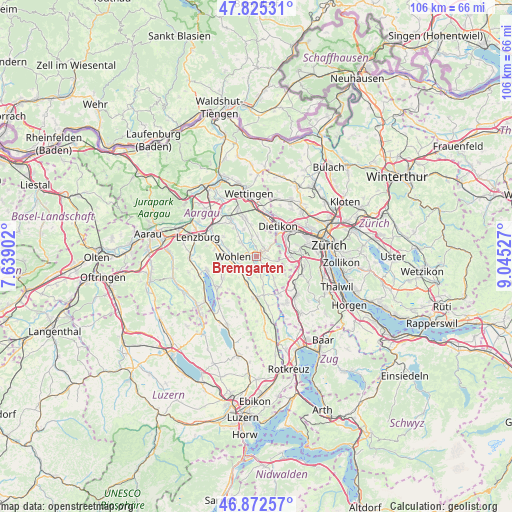
Bremgarten GPS coordinates[2]
47° 21' 3.924" North, 8° 20' 31.704" East
| Map corner | latitude | longitude |
|---|---|---|
| Upper-left | 47.82531°, | 7.63902° |
| Center: | 47.35109°, | 8.34214° |
| Lower-right: | 46.87257°, | 9.04527° |
| Map W x H: | 105.9×105.9 km | = 65.8×65.8mi |
| max Lat: | 47.76737° ⇑35.1% North |
| Bremgarten: | 47.35109° |
| min Lat: | ⇓64.9% South 45.83203° |
| min Long | Bremgarten | max Long |
| 5.97153° | 8.34214° | 10.44624° |
| W 47.8%⇐ | ⇒52.2% E |
Elevation
Elevation of Bremgarten is 389 m = 1276 ft, and this is 169.2 m = 555 ft below average elevation for this country.
| Max E: |
1845 m = 6053 ft | 91.1% |
| Avg. | 558.2 m = 1831 ft | |
| Bremgarten | 389 m = 1276 ft | |
Min E: |
197 m = 646 ft | 8.9% |
See also: Switzerland elevation on elevation.city.
Geographical zone
Bremgarten is located in North temperate zone (between Tropic of Cancer and the Arctic Circle). Distance of this North polar circle is 2136.2 km =1327.4 mi to North.| Distance of | km | miles | from Bremgarten |
|---|---|---|---|
| North Pole | 4742.1 | 2946.6 | to North |
| Arctic Circle | 2136.2 | 1327.4 | to North |
| Tropic Cancer | 2659 | 1652.2 | to South |
| Equator | 5264.9 | 3271.5 | to South |


Nearby cities:
15 places around Bremgarten: (largest is in red/bold)
• Berikon
2.3 km =1.4 mi,  88°
88°
• Besenbüren
4.1 km =2.5 mi,  176°
176°
• Bünzen
4.8 km =3 mi,  196°
196°
• Dietikon / Almend
7 km =4.3 mi,  32°
32°
• Dietikon / Kreuzacker
7 km =4.3 mi,  39°
39°
• Dietikon / Oberdorf
6.8 km =4.2 mi, 35°
• Dietikon / Rütematt
6.5 km =4 mi, 43°
• Künten
4.3 km =2.7 mi,  348°
348°
• Oberlunkhofen
5.7 km =3.5 mi,  138°
138°
• Rottenschwil
4.4 km =2.7 mi,  160°
160°
• Rudolfstetten
3.7 km =2.3 mi,  52°
52°
• Unterlunkhofen
4.4 km =2.7 mi, 138°
• Urdorf / Baumgarten
6.7 km =4.2 mi,  62°
62°
• Waltenschwil
3.9 km =2.4 mi,  239°
239°
• Wohlen
5 km =3.1 mi,  269°
269°
Sources, notices
• [Note1] Compared only with cities in Switzerland existing in our database
• [Src1] Map data: © OpenStreetMap contributors (CC-BY-SA)
• [Src2] Other city data from geonames.org with taken over terms of usage.
• [Src3] Geographical zone / Annual Mean Temperature by Robert A. Rohde @ Wikipedia
