Rudolfstetten geodata
Rudolfstetten (Aargau) is a populated place; located in Switzerland in Europe/Zurich (GMT+2) time zone. With population of 3,800 people, there are 470 cities with bigger population in this country. Compared to other cities in Switzerland, 67.8% of cities are located further ↓South; 51.2% of cities are located further →East and 51.8% of cities have lower elevation than Rudolfstetten. Note1
Administrative division(s):
- Level 1: Aargau
- Level 2: Bezirk Bremgarten
- Level 3: Rudolfstetten-Friedlisberg


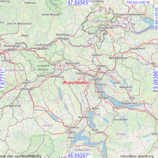
Rudolfstetten GPS coordinates[2]
47° 22' 15.636" North, 8° 22' 50.988" East
| Map corner | latitude | longitude |
|---|---|---|
| Upper-left | 47.84505°, | 7.67771° |
| Center: | 47.37101°, | 8.38083° |
| Lower-right: | 46.89267°, | 9.08396° |
| Map W x H: | 105.9×105.9 km | = 65.8×65.8mi |
| max Lat: | 47.76737° ⇑32.2% North |
| Rudolfstetten: | 47.37101° |
| min Lat: | ⇓67.8% South 45.83203° |
| min Long | Rudolfstetten | max Long |
| 5.97153° | 8.38083° | 10.44624° |
| W 48.8%⇐ | ⇒51.2% E |
Elevation
Elevation of Rudolfstetten is 483 m = 1585 ft, and this is 75.2 m = 247 ft below average elevation for this country.
| Max E: |
1845 m = 6053 ft | 48.2% |
| Avg. | 558.2 m = 1831 ft | |
| Rudolfstetten | 483 m = 1585 ft | |
Min E: |
197 m = 646 ft | 51.8% |
See also: Switzerland elevation on elevation.city.
Geographical zone
Rudolfstetten is located in North temperate zone (between Tropic of Cancer and the Arctic Circle). Distance of this North polar circle is 2134 km =1326 mi to North.| Distance of | km | miles | from Rudolfstetten |
|---|---|---|---|
| North Pole | 4739.9 | 2945.2 | to North |
| Arctic Circle | 2134 | 1326 | to North |
| Tropic Cancer | 2661.2 | 1653.6 | to South |
| Equator | 5267.2 | 3272.9 | to South |


Nearby cities:
15 places around Rudolfstetten: (largest is in red/bold)
• Berikon
2.3 km =1.4 mi,  196°
196°
• Bremgarten
3.7 km =2.3 mi,  232°
232°
• Dietikon
3.7 km =2.3 mi,  23°
23°
• Dietikon / Almend
3.8 km =2.4 mi,  12°
12°
• Dietikon / Guggenbühl
3.8 km =2.4 mi,  32°
32°
• Dietikon / Kreuzacker
3.5 km =2.2 mi, 26°
• Dietikon / Oberdorf
3.4 km =2.1 mi, 16°
• Dietikon / Rütematt
3 km =1.9 mi, 31°
• Urdorf
3.7 km =2.3 mi,  65°
65°
• Urdorf / Baumgarten
3.2 km =2 mi, 73°
• Urdorf / Bodenfeld
3.7 km =2.3 mi,  57°
57°
• Urdorf / Heidenkeller
3.8 km =2.4 mi, 66°
• Urdorf / Nieder-Urdorf
3.8 km =2.4 mi,  50°
50°
• Urdorf / Oberurdorf
3.4 km =2.1 mi, 71°
• Urdorf / Zentrum
3.6 km =2.2 mi, 62°
Sources, notices
• [Note1] Compared only with cities in Switzerland existing in our database
• [Src1] Map data: © OpenStreetMap contributors (CC-BY-SA)
• [Src2] Other city data from geonames.org with taken over terms of usage.
• [Src3] Geographical zone / Annual Mean Temperature by Robert A. Rohde @ Wikipedia
