Benglen geodata
Benglen (Zurich) is a populated place; located in Switzerland in Europe/Zurich (GMT+2) time zone. With population of 1,937 people, there are 858 cities with bigger population in this country. Compared to other cities in Switzerland, 66% of cities are located further ↓South; 69.4% of cities are located further ←West and 69.8% of cities have lower elevation than Benglen. Note1


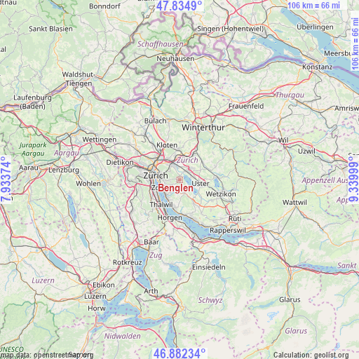
Benglen GPS coordinates[2]
47° 21' 38.772" North, 8° 38' 12.732" East
| Map corner | latitude | longitude |
|---|---|---|
| Upper-left | 47.8349°, | 7.93374° |
| Center: | 47.36077°, | 8.63687° |
| Lower-right: | 46.88234°, | 9.33999° |
| Map W x H: | 105.9×105.9 km | = 65.8×65.8mi |
| max Lat: | 47.76737° ⇑34% North |
| Benglen: | 47.36077° |
| min Lat: | ⇓66% South 45.83203° |
| min Long | Benglen | max Long |
| 5.97153° | 8.63687° | 10.44624° |
| W 69.4%⇐ | ⇒30.6% E |
Elevation
Elevation of Benglen is 572 m = 1877 ft, and this is 13.8 m = 45 ft above average elevation for this country.
| Max E: |
1845 m = 6053 ft | 30.2% |
| Benglen | 572 m 1877 ft | |
| Avg. | 558.2 m = 1831 ft | |
Min E: |
197 m = 646 ft | 69.8% |
See also: Switzerland elevation on elevation.city.
Geographical zone
Benglen is located in North temperate zone (between Tropic of Cancer and the Arctic Circle). Distance of this North polar circle is 2135.2 km =1326.8 mi to North.| Distance of | km | miles | from Benglen |
|---|---|---|---|
| North Pole | 4741 | 2945.9 | to North |
| Arctic Circle | 2135.2 | 1326.8 | to North |
| Tropic Cancer | 2660.1 | 1652.9 | to South |
| Equator | 5266 | 3272.1 | to South |


Nearby cities:
15 places around Benglen: (largest is in red/bold)
• Binz
0.9 km =0.6 mi,  237°
237°
• Ebmatingen
1.2 km =0.7 mi,  168°
168°
• Ebmatingen / Bachtobel
1 km =0.6 mi,  161°
161°
• Ebmatingen / Lebern
1.4 km =0.9 mi, 163°
• Fällanden
1.2 km =0.7 mi,  6°
6°
• Pfaffhausen
1.1 km =0.7 mi,  294°
294°
• Schwerzenbach
2.8 km =1.7 mi,  32°
32°
• Schwerzenbach / Blatten
2.7 km =1.7 mi,  21°
21°
• Schwerzenbach / Chimli
3.3 km =2.1 mi, 30°
• Schwerzenbach / Chropfacher
3 km =1.9 mi, 30°
• Schwerzenbach / Widacher
2.8 km =1.7 mi, 33°
• Zimikon / Rütiwies
3.4 km =2.1 mi,  40°
40°
• Zollikerberg
3.2 km =2 mi, 237°
• Zumikon / Fröschgüllen
3.2 km =2 mi,  211°
211°
• Zürich (Kreis 7) / Looren
3.3 km =2.1 mi,  276°
276°
Sources, notices
• [Note1] Compared only with cities in Switzerland existing in our database
• [Src1] Map data: © OpenStreetMap contributors (CC-BY-SA)
• [Src2] Other city data from geonames.org with taken over terms of usage.
• [Src3] Geographical zone / Annual Mean Temperature by Robert A. Rohde @ Wikipedia
