Oberriet geodata
Oberriet (Saint Gallen) is a populated place; located in Switzerland in Europe/Zurich (GMT+2) time zone. With population of 7,675 people, there are 211 cities with bigger population in this country. Compared to other cities in Switzerland, 61% of cities are located further ↓South; 97.9% of cities are located further ←West and 81.2% of cities have higher elevation than Oberriet. Note1
Administrative division(s):
- Level 1: Saint Gallen
- Level 2: Wahlkreis Rheintal
- Level 3: Oberriet (SG)


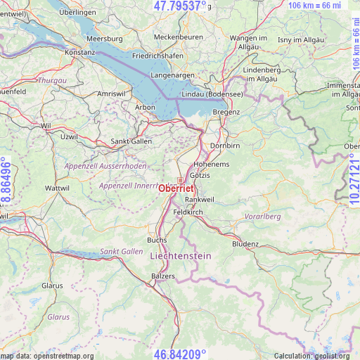
Oberriet GPS coordinates[2]
47° 19' 15.168" North, 9° 34' 5.088" East
| Map corner | latitude | longitude |
|---|---|---|
| Upper-left | 47.79537°, | 8.86496° |
| Center: | 47.32088°, | 9.56808° |
| Lower-right: | 46.84209°, | 10.27121° |
| Map W x H: | 106×106 km | = 65.9×65.9mi |
| max Lat: | 47.76737° ⇑39% North |
| Oberriet: | 47.32088° |
| min Lat: | ⇓61% South 45.83203° |
| min Long | Oberriet | max Long |
| 5.97153° | 9.56808° | 10.44624° |
| W 97.9%⇐ | ⇒2.1% E |
Elevation
Elevation of Oberriet is 419 m = 1375 ft, and this is 139.2 m = 457 ft below average elevation for this country.
| Max E: |
1845 m = 6053 ft | 81.2% |
| Avg. | 558.2 m = 1831 ft | |
| Oberriet | 419 m = 1375 ft | |
Min E: |
197 m = 646 ft | 18.8% |
See also: Switzerland elevation on elevation.city.
Geographical zone
Oberriet is located in North temperate zone (between Tropic of Cancer and the Arctic Circle). Distance of this North polar circle is 2139.6 km =1329.5 mi to North.| Distance of | km | miles | from Oberriet |
|---|---|---|---|
| North Pole | 4745.5 | 2948.7 | to North |
| Arctic Circle | 2139.6 | 1329.5 | to North |
| Tropic Cancer | 2655.7 | 1650.2 | to South |
| Equator | 5261.6 | 3269.4 | to South |


Nearby cities:
15 places around Oberriet: (largest is in red/bold)
• Altstätten
6.5 km =4 mi,  346°
346°
• Appenzell
12 km =7.5 mi,  275°
275°
• Au
13.2 km =8.2 mi,  22°
22°
• Balgach
9.9 km =6.2 mi, 17°
• Bühler
12.3 km =7.6 mi,  298°
298°
• Diepoldsau
9.8 km =6.1 mi,  42°
42°
• Eichberg
3.8 km =2.4 mi,  312°
312°
• Gais
9.7 km =6 mi, 297°
• Haag (Rheintal)
13.7 km =8.5 mi,  205°
205°
• Oberegg
11.7 km =7.3 mi, 353°
• Rebstein
8.7 km =5.4 mi,  8°
8°
• Rehetobel
13.3 km =8.3 mi,  331°
331°
• Rüthi
3.7 km =2.3 mi,  217°
217°
• Sennwald
8.3 km =5.2 mi, 216°
• Trogen
12.4 km =7.7 mi,  321°
321°
Sources, notices
• [Note1] Compared only with cities in Switzerland existing in our database
• [Src1] Map data: © OpenStreetMap contributors (CC-BY-SA)
• [Src2] Other city data from geonames.org with taken over terms of usage.
• [Src3] Geographical zone / Annual Mean Temperature by Robert A. Rohde @ Wikipedia
