Dardagny geodata
Dardagny (Geneva) is a populated place; located in Switzerland in Europe/Zurich (GMT+2) time zone. With population of 1,329 people, there are 1116 cities with bigger population in this country. Compared to other cities in Switzerland, 94.3% of cities are located further ↑North; 99.9% of cities are located further →East and 72.4% of cities have higher elevation than Dardagny. Note1


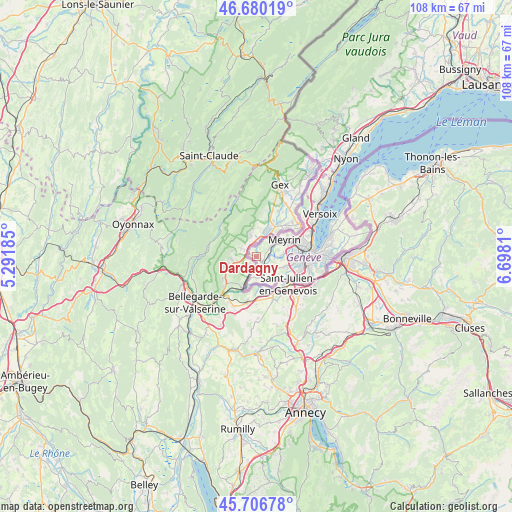
Dardagny GPS coordinates[2]
46° 11' 44.304" North, 5° 59' 41.892" East
| Map corner | latitude | longitude |
|---|---|---|
| Upper-left | 46.68019°, | 5.29185° |
| Center: | 46.19564°, | 5.99497° |
| Lower-right: | 45.70678°, | 6.6981° |
| Map W x H: | 108.2×108.2 km | = 67.2×67.2mi |
| max Lat: | 47.76737° ⇑94.3% North |
| Dardagny: | 46.19564° |
| min Lat: | ⇓5.7% South 45.83203° |
| min Long | Dardagny | max Long |
| 5.97153° | 5.99497° | 10.44624° |
| W 0.1%⇐ | ⇒99.9% E |
Elevation
Elevation of Dardagny is 436 m = 1430 ft, and this is 122.2 m = 401 ft below average elevation for this country.
| Max E: |
1845 m = 6053 ft | 72.4% |
| Avg. | 558.2 m = 1831 ft | |
| Dardagny | 436 m = 1430 ft | |
Min E: |
197 m = 646 ft | 27.6% |
See also: Switzerland elevation on elevation.city.
Geographical zone
Dardagny is located in North temperate zone (between Tropic of Cancer and the Arctic Circle). Distance of this North polar circle is 2264.7 km =1407.2 mi to North.| Distance of | km | miles | from Dardagny |
|---|---|---|---|
| North Pole | 4870.6 | 3026.4 | to North |
| Arctic Circle | 2264.7 | 1407.2 | to North |
| Tropic Cancer | 2530.6 | 1572.4 | to South |
| Equator | 5136.5 | 3191.7 | to South |


Nearby cities:
15 places around Dardagny: (largest is in red/bold)
• Aire-la-Ville
3.7 km =2.3 mi,  98°
98°
• Bernex
6.5 km =4 mi,  108°
108°
• Carouge
11.2 km =7 mi, 98°
• Cartigny
3.1 km =1.9 mi,  141°
141°
• Chancy
5.4 km =3.4 mi,  199°
199°
• Confignon
7.3 km =4.5 mi, 109°
• Lancy
9.2 km =5.7 mi,  94°
94°
• Le Grand-Saconnex
10.5 km =6.5 mi,  67°
67°
• Les Avanchets
9.2 km =5.7 mi, 71°
• Meyrin
7.8 km =4.8 mi,  56°
56°
• Onex
8.4 km =5.2 mi, 98°
• Plan-les-Ouates
9.9 km =6.2 mi, 108°
• Satigny
3.8 km =2.4 mi, 55°
• Soral
6.9 km =4.3 mi,  147°
147°
• Vernier
7.3 km =4.5 mi, 71°
Sources, notices
• [Note1] Compared only with cities in Switzerland existing in our database
• [Src1] Map data: © OpenStreetMap contributors (CC-BY-SA)
• [Src2] Other city data from geonames.org with taken over terms of usage.
• [Src3] Geographical zone / Annual Mean Temperature by Robert A. Rohde @ Wikipedia
