Cernier geodata
Cernier (Neuchâtel) is a seat of a second-order administrative division; located in Switzerland in Europe/Zurich (GMT+2) time zone. With population of 2,080 people, there are 811 cities with bigger population in this country. Compared to other cities in Switzerland, 61.2% of cities are located further ↑North; 89.6% of cities are located further →East and 90.2% of cities have lower elevation than Cernier. Note1


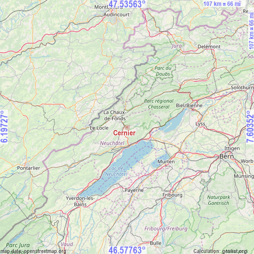
Cernier GPS coordinates[2]
47° 3' 31.608" North, 6° 54' 1.44" East
| Map corner | latitude | longitude |
|---|---|---|
| Upper-left | 47.53563°, | 6.19727° |
| Center: | 47.05878°, | 6.9004° |
| Lower-right: | 46.57763°, | 7.60352° |
| Map W x H: | 106.5×106.5 km | = 66.2×66.2mi |
| max Lat: | 47.76737° ⇑61.2% North |
| Cernier: | 47.05878° |
| min Lat: | ⇓38.8% South 45.83203° |
| min Long | Cernier | max Long |
| 5.97153° | 6.9004° | 10.44624° |
| W 10.4%⇐ | ⇒89.6% E |
Elevation
Elevation of Cernier is 825 m = 2707 ft, and this is 266.8 m = 875 ft above average elevation for this country.
| Max E: |
1845 m = 6053 ft | 9.8% |
| Cernier | 825 m 2707 ft | |
| Avg. | 558.2 m = 1831 ft | |
Min E: |
197 m = 646 ft | 90.2% |
See also: Switzerland elevation on elevation.city.
Geographical zone
Cernier is located in North temperate zone (between Tropic of Cancer and the Arctic Circle). Distance of this North polar circle is 2168.7 km =1347.6 mi to North.| Distance of | km | miles | from Cernier |
|---|---|---|---|
| North Pole | 4774.6 | 2966.8 | to North |
| Arctic Circle | 2168.7 | 1347.6 | to North |
| Tropic Cancer | 2626.5 | 1632 | to South |
| Equator | 5232.4 | 3251.3 | to South |


Nearby cities:
15 places around Cernier: (largest is in red/bold)
• Auvernier
9.4 km =5.8 mi,  189°
189°
• Boudevilliers
3.6 km =2.2 mi, 193°
• Chézard-Saint-Martin
2.6 km =1.6 mi,  71°
71°
• Cornaux
9.2 km =5.7 mi,  103°
103°
• Dombresson
4.7 km =2.9 mi, 71°
• Fontainemelon
1.1 km =0.7 mi,  247°
247°
• Grand-Savagnier
4.2 km =2.6 mi, 101°
• La Chaux-de-Fonds
7.3 km =4.5 mi,  309°
309°
• La Sagne
7 km =4.3 mi,  258°
258°
• Les Geneveys-sur-Coffrane
6.1 km =3.8 mi,  217°
217°
• Marin-Epagnier
9.2 km =5.7 mi,  125°
125°
• Neuchâtel
7.8 km =4.8 mi,  162°
162°
• Peseux
8 km =5 mi, 186°
• Rochefort
11.4 km =7.1 mi, 217°
• Saint-Blaise
8.2 km =5.1 mi, 126°
Sources, notices
• [Note1] Compared only with cities in Switzerland existing in our database
• [Src1] Map data: © OpenStreetMap contributors (CC-BY-SA)
• [Src2] Other city data from geonames.org with taken over terms of usage.
• [Src3] Geographical zone / Annual Mean Temperature by Robert A. Rohde @ Wikipedia
