Langnau geodata
Langnau (Bern) is a seat of a second-order administrative division; located in Switzerland in Europe/Zurich (GMT+2) time zone. With population of 8,784 people, there are 184 cities with bigger population in this country. Compared to other cities in Switzerland, 67.5% of cities are located further ↑North; 66% of cities are located further →East and 81.1% of cities have lower elevation than Langnau. Note1


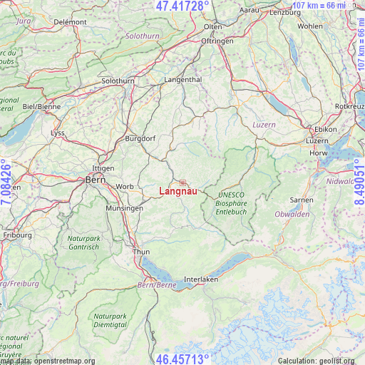
Langnau GPS coordinates[2]
46° 56' 21.696" North, 7° 47' 14.568" East
| Map corner | latitude | longitude |
|---|---|---|
| Upper-left | 47.41728°, | 7.08426° |
| Center: | 46.93936°, | 7.78738° |
| Lower-right: | 46.45713°, | 8.49051° |
| Map W x H: | 106.8×106.8 km | = 66.4×66.4mi |
| max Lat: | 47.76737° ⇑67.5% North |
| Langnau: | 46.93936° |
| min Lat: | ⇓32.5% South 45.83203° |
| min Long | Langnau | max Long |
| 5.97153° | 7.78738° | 10.44624° |
| W 34%⇐ | ⇒66% E |
Elevation
Elevation of Langnau is 677 m = 2221 ft, and this is 118.8 m = 390 ft above average elevation for this country.
| Max E: |
1845 m = 6053 ft | 18.9% |
| Langnau | 677 m 2221 ft | |
| Avg. | 558.2 m = 1831 ft | |
Min E: |
197 m = 646 ft | 81.1% |
See also: Switzerland elevation on elevation.city.
Geographical zone
Langnau is located in North temperate zone (between Tropic of Cancer and the Arctic Circle). Distance of this North polar circle is 2182 km =1355.8 mi to North.| Distance of | km | miles | from Langnau |
|---|---|---|---|
| North Pole | 4787.9 | 2975.1 | to North |
| Arctic Circle | 2182 | 1355.8 | to North |
| Tropic Cancer | 2613.2 | 1623.8 | to South |
| Equator | 5219.2 | 3243.1 | to South |


Nearby cities:
15 places around Langnau: (largest is in red/bold)
• Arni
9.3 km =5.8 mi,  267°
267°
• Bowil
8.5 km =5.3 mi,  232°
232°
• Eggiwil
7.1 km =4.4 mi,  174°
174°
• Escholzmatt
11.5 km =7.1 mi,  104°
104°
• Landiswil
8.4 km =5.2 mi,  284°
284°
• Lauperswil
4.5 km =2.8 mi,  310°
310°
• Lützelflüh
10.5 km =6.5 mi,  316°
316°
• Oberhünigen
11.9 km =7.4 mi,  236°
236°
• Rüderswil
7 km =4.3 mi, 314°
• Signau
5.3 km =3.3 mi,  245°
245°
• Sumiswald
10.3 km =6.4 mi,  341°
341°
• Trachselwald
9.5 km =5.9 mi, 335°
• Trub
7 km =4.3 mi,  87°
87°
• Trubschachen
4.8 km =3 mi,  113°
113°
• Zäziwil
10.4 km =6.5 mi, 246°
Sources, notices
• [Note1] Compared only with cities in Switzerland existing in our database
• [Src1] Map data: © OpenStreetMap contributors (CC-BY-SA)
• [Src2] Other city data from geonames.org with taken over terms of usage.
• [Src3] Geographical zone / Annual Mean Temperature by Robert A. Rohde @ Wikipedia
