Attinghausen geodata
Attinghausen (Uri) is a populated place; located in Switzerland in Europe/Zurich (GMT+2) time zone. With population of 1,515 people, there are 1028 cities with bigger population in this country. Compared to other cities in Switzerland, 71.5% of cities are located further ↑North; 68.9% of cities are located further ←West and 50.3% of cities have higher elevation than Attinghausen. Note1


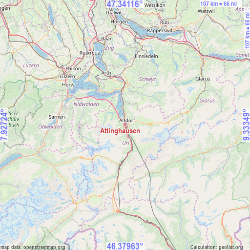
Attinghausen GPS coordinates[2]
46° 51' 45.18" North, 8° 37' 49.296" East
| Map corner | latitude | longitude |
|---|---|---|
| Upper-left | 47.34116°, | 7.92724° |
| Center: | 46.86255°, | 8.63036° |
| Lower-right: | 46.37963°, | 9.33349° |
| Map W x H: | 106.9×106.9 km | = 66.4×66.4mi |
| max Lat: | 47.76737° ⇑71.5% North |
| Attinghausen: | 46.86255° |
| min Lat: | ⇓28.5% South 45.83203° |
| min Long | Attinghausen | max Long |
| 5.97153° | 8.63036° | 10.44624° |
| W 68.9%⇐ | ⇒31.1% E |
Elevation
Elevation of Attinghausen is 477 m = 1565 ft, and this is 81.2 m = 266 ft below average elevation for this country.
| Max E: |
1845 m = 6053 ft | 50.3% |
| Avg. | 558.2 m = 1831 ft | |
| Attinghausen | 477 m = 1565 ft | |
Min E: |
197 m = 646 ft | 49.7% |
See also: Switzerland elevation on elevation.city.
Geographical zone
Attinghausen is located in North temperate zone (between Tropic of Cancer and the Arctic Circle). Distance of this North polar circle is 2190.5 km =1361.1 mi to North.| Distance of | km | miles | from Attinghausen |
|---|---|---|---|
| North Pole | 4796.4 | 2980.3 | to North |
| Arctic Circle | 2190.5 | 1361.1 | to North |
| Tropic Cancer | 2604.7 | 1618.5 | to South |
| Equator | 5210.6 | 3237.7 | to South |


Nearby cities:
15 places around Attinghausen: (largest is in red/bold)
• Altdorf
2.3 km =1.4 mi,  28°
28°
• Bauen
9 km =5.6 mi,  334°
334°
• Bürglen
3 km =1.9 mi,  61°
61°
• Emmetten
13.7 km =8.5 mi,  319°
319°
• Erstfeld
5.1 km =3.2 mi,  162°
162°
• Flüelen
4.7 km =2.9 mi,  354°
354°
• Gurtnellen
13.8 km =8.6 mi,  180°
180°
• Isenthal
7.5 km =4.7 mi, 315°
• Morschach
13.4 km =8.3 mi,  356°
356°
• Schattdorf
1.9 km =1.2 mi,  79°
79°
• Seedorf
2.4 km =1.5 mi, 333°
• Seelisberg
12.7 km =7.9 mi,  344°
344°
• Silenen
8.8 km =5.5 mi, 158°
• Spiringen
7.7 km =4.8 mi, 81°
• Unterschächen
10.6 km =6.6 mi,  89°
89°
Sources, notices
• [Note1] Compared only with cities in Switzerland existing in our database
• [Src1] Map data: © OpenStreetMap contributors (CC-BY-SA)
• [Src2] Other city data from geonames.org with taken over terms of usage.
• [Src3] Geographical zone / Annual Mean Temperature by Robert A. Rohde @ Wikipedia
