Spiringen geodata
Spiringen (Uri) is a populated place; located in Switzerland in Europe/Zurich (GMT+2) time zone. With population of 973 people, there are 1348 cities with bigger population in this country. Compared to other cities in Switzerland, 71.1% of cities are located further ↑North; 77.1% of cities are located further ←West and 93.9% of cities have lower elevation than Spiringen. Note1


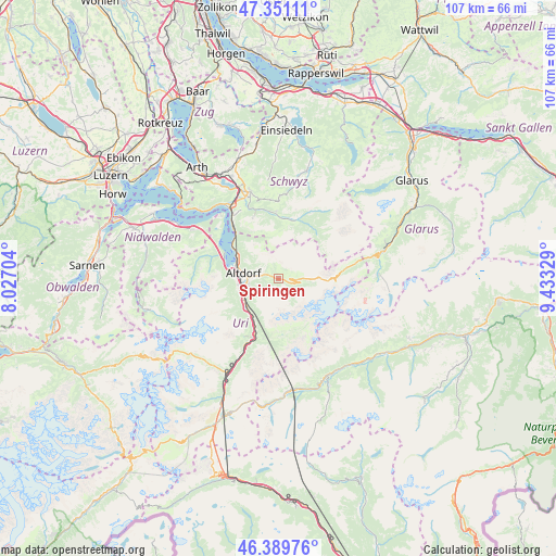
Spiringen GPS coordinates[2]
46° 52' 21.324" North, 8° 43' 48.612" East
| Map corner | latitude | longitude |
|---|---|---|
| Upper-left | 47.35111°, | 8.02704° |
| Center: | 46.87259°, | 8.73017° |
| Lower-right: | 46.38976°, | 9.43329° |
| Map W x H: | 106.9×106.9 km | = 66.4×66.4mi |
| max Lat: | 47.76737° ⇑71.1% North |
| Spiringen: | 46.87259° |
| min Lat: | ⇓28.9% South 45.83203° |
| min Long | Spiringen | max Long |
| 5.97153° | 8.73017° | 10.44624° |
| W 77.1%⇐ | ⇒22.9% E |
Elevation
Elevation of Spiringen is 948 m = 3110 ft, and this is 389.8 m = 1279 ft above average elevation for this country.
| Max E: |
1845 m = 6053 ft | 6.1% |
| Spiringen | 948 m 3110 ft | |
| Avg. | 558.2 m = 1831 ft | |
Min E: |
197 m = 646 ft | 93.9% |
See also: Switzerland elevation on elevation.city.
Geographical zone
Spiringen is located in North temperate zone (between Tropic of Cancer and the Arctic Circle). Distance of this North polar circle is 2189.4 km =1360.4 mi to North.| Distance of | km | miles | from Spiringen |
|---|---|---|---|
| North Pole | 4795.3 | 2979.7 | to North |
| Arctic Circle | 2189.4 | 1360.4 | to North |
| Tropic Cancer | 2605.8 | 1619.2 | to South |
| Equator | 5211.7 | 3238.4 | to South |


Nearby cities:
15 places around Spiringen: (largest is in red/bold)
• Altdorf
6.6 km =4.1 mi,  277°
277°
• Attinghausen
7.7 km =4.8 mi,  261°
261°
• Bauen
13.5 km =8.4 mi,  301°
301°
• Bürglen
4.9 km =3 mi,  273°
273°
• Erstfeld
8.5 km =5.3 mi,  225°
225°
• Flüelen
8.8 km =5.5 mi,  293°
293°
• Illgau
12.8 km =8 mi,  358°
358°
• Isenthal
13.5 km =8.4 mi, 288°
• Morschach
14.9 km =9.3 mi,  325°
325°
• Muotathal
11.9 km =7.4 mi,  12°
12°
• Schattdorf
5.8 km =3.6 mi, 262°
• Seedorf
8.7 km =5.4 mi, 276°
• Seelisberg
15.6 km =9.7 mi,  315°
315°
• Silenen
10.2 km =6.3 mi,  205°
205°
• Unterschächen
3.2 km =2 mi,  110°
110°
Sources, notices
• [Note1] Compared only with cities in Switzerland existing in our database
• [Src1] Map data: © OpenStreetMap contributors (CC-BY-SA)
• [Src2] Other city data from geonames.org with taken over terms of usage.
• [Src3] Geographical zone / Annual Mean Temperature by Robert A. Rohde @ Wikipedia
