Wettswil / Wettswil (Dorf) geodata
Wettswil / Wettswil (Dorf) (Zurich) is a section of populated place; located in Switzerland in Europe/Zurich (GMT+2) time zone. With population of 3,605 people, there are 495 cities with bigger population in this country. Compared to other cities in Switzerland, 63.8% of cities are located further ↓South; 55.3% of cities are located further ←West and 68.1% of cities have lower elevation than Wettswil / Wettswil (Dorf). Note1
Current local time in Wettswil / Wettswil (Dorf):
08:52 AM, SaturdayDifference from your time zone: hours


Wettswil / Wettswil (Dorf) GPS coordinates[2]
47° 20' 29.472" North, 8° 28' 17.364" East
| Map corner | latitude | longitude |
|---|---|---|
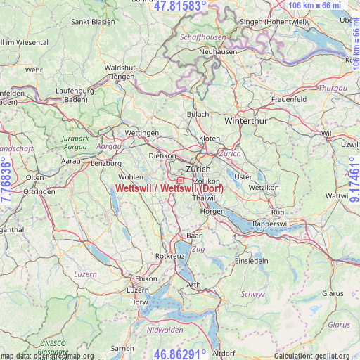
| Upper-left | 47.81583°, | 7.76836° |
| Center: | 47.34152°, | 8.47149° |
| Lower-right: | 46.86291°, | 9.17461° |
| Map W x H: | 106×106 km | = 65.9×65.9mi |
| max Lat: | 47.76737° ⇑36.2% North |
| Wettswil / Wettswil (Dorf): | 47.34152° |
| min Lat: | ⇓63.8% South 45.83203° |
| min Long | Wettswil / Wett | max Long |
| 5.97153° | 8.47149° | 10.44624° |
| W 55.3%⇐ | ⇒44.7% E |
Elevation
Elevation of Wettswil / Wettswil (Dorf) is 563 m = 1847 ft, and this is 4.8 m = 16 ft above average elevation for this country.
| Max E: |
1845 m = 6053 ft | 31.9% |
| Wettswil / Wettswil (Dorf) | 563 m 1847 ft | |
| Avg. | 558.2 m = 1831 ft | |
Min E: |
197 m = 646 ft | 68.1% |
See also: Switzerland elevation on elevation.city.
Geographical zone
Wettswil / Wettswil (Dorf) is located in North temperate zone (between Tropic of Cancer and the Arctic Circle). Distance of this North polar circle is 2137.3 km =1328.1 mi to North.| Distance of | km | miles | from Wettswil / Wettswil (Dorf) |
|---|---|---|---|
| North Pole | 4743.2 | 2947.3 | to North |
| Arctic Circle | 2137.3 | 1328.1 | to North |
| Tropic Cancer | 2658 | 1651.6 | to South |
| Equator | 5263.9 | 3270.8 | to South |


Nearby cities:
15 places around Wettswil / Wettswil (Dorf): (largest is in red/bold)
• Aesch
2.4 km =1.5 mi,  256°
256°
• Birmensdorf
2.7 km =1.7 mi,  304°
304°
• Birmensdorf / Haslen
2.2 km =1.4 mi,  338°
338°
• Bonstetten
3 km =1.9 mi,  184°
184°
• Schachen
1.9 km =1.2 mi, 177°
• Sellenbüren
0.9 km =0.6 mi,  75°
75°
• Uitikon
3.3 km =2.1 mi, 340°
• Uitikon / Halde
3.6 km =2.2 mi, 341°
• Uitikon / Uitikon (Dorfkern)
3.5 km =2.2 mi, 336°
• Uitikon / Waldegg
2.5 km =1.6 mi,  347°
347°
• Wettswil
0.6 km =0.4 mi,  149°
149°
• Wettswil / Ausser-Dorf
1.1 km =0.7 mi,  157°
157°
• Zürich (Kreis 2) / Unter-Leimbach
3.3 km =2.1 mi,  105°
105°
• Zürich (Kreis 3)
3 km =1.9 mi,  52°
52°
• Zürich (Kreis 3) / Friesenberg
3.5 km =2.2 mi,  44°
44°
Sources, notices
• [Note1] Compared only with cities in Switzerland existing in our database
• [Src1] Map data: © OpenStreetMap contributors (CC-BY-SA)
• [Src2] Other city data from geonames.org with taken over terms of usage.
• [Src3] Geographical zone / Annual Mean Temperature by Robert A. Rohde @ Wikipedia
