Wettswil / Ausser-Dorf geodata
Wettswil / Ausser-Dorf (Zurich) is a section of populated place; located in Switzerland in Europe/Zurich (GMT+2) time zone. With population of 1,438 people, there are 1061 cities with bigger population in this country. Compared to other cities in Switzerland, 62.5% of cities are located further ↓South; 55.7% of cities are located further ←West and 70.6% of cities have lower elevation than Wettswil / Ausser-Dorf. Note1
Current local time in Wettswil / Ausser-Dorf:
07:36 AM, SaturdayDifference from your time zone: hours


Wettswil / Ausser-Dorf GPS coordinates[2]
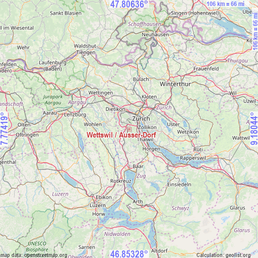
47° 19' 55.092" North, 8° 28' 38.352" East
| Map corner | latitude | longitude |
|---|---|---|
| Upper-left | 47.80636°, | 7.77419° |
| Center: | 47.33197°, | 8.47732° |
| Lower-right: | 46.85328°, | 9.18044° |
| Map W x H: | 106×106 km | = 65.9×65.9mi |
| max Lat: | 47.76737° ⇑37.5% North |
| Wettswil / Ausser-Dorf: | 47.33197° |
| min Lat: | ⇓62.5% South 45.83203° |
| min Long | Wettswil / Auss | max Long |
| 5.97153° | 8.47732° | 10.44624° |
| W 55.7%⇐ | ⇒44.3% E |
Elevation
Elevation of Wettswil / Ausser-Dorf is 575 m = 1886 ft, and this is 16.8 m = 55 ft above average elevation for this country.
| Max E: |
1845 m = 6053 ft | 29.4% |
| Wettswil / Ausser-Dorf | 575 m 1886 ft | |
| Avg. | 558.2 m = 1831 ft | |
Min E: |
197 m = 646 ft | 70.6% |
See also: Switzerland elevation on elevation.city.
Geographical zone
Wettswil / Ausser-Dorf is located in North temperate zone (between Tropic of Cancer and the Arctic Circle). Distance of this North polar circle is 2138.4 km =1328.7 mi to North.| Distance of | km | miles | from Wettswil / Ausser-Dorf |
|---|---|---|---|
| North Pole | 4744.2 | 2947.9 | to North |
| Arctic Circle | 2138.4 | 1328.7 | to North |
| Tropic Cancer | 2656.9 | 1650.9 | to South |
| Equator | 5262.8 | 3270.2 | to South |


Nearby cities:
15 places around Wettswil / Ausser-Dorf: (largest is in red/bold)
• Adliswil / Hündli-Zopf
3.6 km =2.2 mi,  118°
118°
• Adliswil / Oberleimbach
3.1 km =1.9 mi,  114°
114°
• Adliswil / Sihlhof
3.5 km =2.2 mi, 107°
• Aesch
2.8 km =1.7 mi,  280°
280°
• Birmensdorf / Haslen
3.4 km =2.1 mi,  337°
337°
• Bonstetten
2 km =1.2 mi,  199°
199°
• Schachen
0.9 km =0.6 mi, 202°
• Sellenbüren
1.4 km =0.9 mi,  18°
18°
• Uitikon / Waldegg
3.6 km =2.2 mi, 344°
• Wettswil
0.6 km =0.4 mi,  345°
345°
• Wettswil / Wettswil (Dorf)
1.1 km =0.7 mi, 337°
• Zürich (Kreis 2)
3.4 km =2.1 mi,  79°
79°
• Zürich (Kreis 2) / Mittel-Leimbach
2.9 km =1.8 mi,  104°
104°
• Zürich (Kreis 2) / Unter-Leimbach
2.8 km =1.7 mi,  86°
86°
• Zürich (Kreis 3)
3.5 km =2.2 mi,  33°
33°
Sources, notices
• [Note1] Compared only with cities in Switzerland existing in our database
• [Src1] Map data: © OpenStreetMap contributors (CC-BY-SA)
• [Src2] Other city data from geonames.org with taken over terms of usage.
• [Src3] Geographical zone / Annual Mean Temperature by Robert A. Rohde @ Wikipedia
