Diessenhofen geodata
Diessenhofen (Thurgau) is a seat of a third-order administrative division; located in Switzerland in Europe/Zurich (GMT+2) time zone. In our database, there are 1823 cities with bigger population. Compared to other cities in Switzerland, 99.2% of cities are located further ↓South; 78.1% of cities are located further ←West and 86.6% of cities have higher elevation than Diessenhofen. Note1


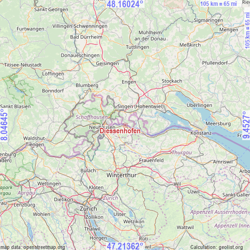
Diessenhofen GPS coordinates[2]
47° 41' 20.688" North, 8° 44' 58.488" East
| Map corner | latitude | longitude |
|---|---|---|
| Upper-left | 48.16024°, | 8.04645° |
| Center: | 47.68908°, | 8.74958° |
| Lower-right: | 47.21362°, | 9.4527° |
| Map W x H: | 105.3×105.3 km | = 65.4×65.4mi |
| max Lat: | 47.76737° ⇑0.8% North |
| Diessenhofen: | 47.68908° |
| min Lat: | ⇓99.2% South 45.83203° |
| min Long | Diessenhofen | max Long |
| 5.97153° | 8.74958° | 10.44624° |
| W 78.1%⇐ | ⇒21.9% E |
Elevation
Elevation of Diessenhofen is 406 m = 1332 ft, and this is 152.2 m = 499 ft below average elevation for this country.
| Max E: |
1845 m = 6053 ft | 86.6% |
| Avg. | 558.2 m = 1831 ft | |
| Diessenhofen | 406 m = 1332 ft | |
Min E: |
197 m = 646 ft | 13.4% |
See also: Switzerland elevation on elevation.city.
Geographical zone
Diessenhofen is located in North temperate zone (between Tropic of Cancer and the Arctic Circle). Distance of this North polar circle is 2098.6 km =1304 mi to North.| Distance of | km | miles | from Diessenhofen |
|---|---|---|---|
| North Pole | 4704.5 | 2923.2 | to North |
| Arctic Circle | 2098.6 | 1304 | to North |
| Tropic Cancer | 2696.6 | 1675.6 | to South |
| Equator | 5302.5 | 3294.8 | to South |


Nearby cities:
15 places around Diessenhofen: (largest is in red/bold)
• Benken
8.2 km =5.1 mi,  240°
240°
• Dörflingen
2.8 km =1.7 mi,  312°
312°
• Feuerthalen
7.9 km =4.9 mi,  271°
271°
• Langwiesen
6.7 km =4.2 mi, 265°
• Oberstammheim
7.3 km =4.5 mi,  149°
149°
• Ossingen
8.8 km =5.5 mi,  190°
190°
• Ramsen
5 km =3.1 mi,  64°
64°
• Schaffhausen
8.6 km =5.3 mi,  276°
276°
• Stein am Rhein
8.9 km =5.5 mi,  111°
111°
• Stetten
8.6 km =5.3 mi, 311°
• Thayngen
7.2 km =4.5 mi,  333°
333°
• Trüllikon
7.5 km =4.7 mi,  217°
217°
• Uhwiesen
8.8 km =5.5 mi,  256°
256°
• Unterstammheim
6.3 km =3.9 mi, 150°
• Wagenhausen
8 km =5 mi, 113°
Sources, notices
• [Note1] Compared only with cities in Switzerland existing in our database
• [Src1] Map data: © OpenStreetMap contributors (CC-BY-SA)
• [Src2] Other city data from geonames.org with taken over terms of usage.
• [Src3] Geographical zone / Annual Mean Temperature by Robert A. Rohde @ Wikipedia
